Pembrokeshire

2020 was certainly a year like no other, and forced me to look closer to home for holidays. During the summer, I’d booked a glamping pod on a farm on the Pembrokeshire coast for 3 days in late November. As autumn progressed and things got worse with the pandemic, I’d resigned myself to not being able to go. As it turned out, there was a short window here in Wales where we were able to travel. And so it was that I set out on a beautiful, crisp, late November morning from Cardiff, and a couple of hours later I stopped for a packed lunch on the beach at Newgale.

Newgale

After lunch I headed a few minutes down the road to Solva and had a brief wander to the lime kilns, before hopping back in the car and carrying on to the small city of St David’s. I visited the cathedral (hence it being a city) as well as the ruins of the Bishop’s Palace.

After a very short walk around the town, I then headed approximately 10 minutes up the road to the farm where my pod was located, in the hamlet of Square and Compass (such a great name!). Whilst it looked as though there were hookups for caravans, there was no one else staying, and so it was a blissfully peaceful few days. The pod was super-cute, and you could just about glimpse the sea from the front decking.

I’d planned myself a little itinerary, and so the next morning, after making a packed lunch, I headed back to St David’s and across to Caerfai Bay. After a walk down to the beach, where I was the only person, I then set off west on the coastal path and arrived at St Non’s Chapel and Well.

It was a glorious late autumn day, and I carried on along the path to Porthclais Harbour, where I found myself a sheltered spot on the harbour wall for lunch.

Porthclais Harbour

After lunch I retraced my steps back along the coastal path, back to Caerfai Bay and my car. I then drove back through St David’s and out to Whitesands Bay. A lovely, sweeping bay, which looked evocative in the setting sun on a winters afternoon. I had a walk to the north of the bay, towards Porthmelgan Beach, and back again, before calling it a day and heading back to my little pod.

Whitesands Bay

The next day it was a short drive in the other direction, to Aberreiddy Beach and the Blue Lagoon, a remnant from this area’s slate mining past. I was so fortunate with the weather, which really highlighted the blue of the Blue Lagoon. I then walked north along the coastal path to Porthgain. This part of the walk was spectacular, hugging the cliffs, and with a couple of detours down to secluded bays.

I arrived in Porthgain at lunchtime and found a picnic bench for my packed lunch, before making the return trip along the coastal path. I then drove to Fishguard (somewhere I’d return to when going to Ireland in 2022), before returning to my pod for a relaxing evening with wine and S1 of Ted Lasso.

This part of Wales is stunningly beautiful and I was so lucky with the weather in November and the ability to travel more than 5 miles from my home during the dark days of the pandemic. I really do recommend it.

Cambrian Mountains

With the current state of the world, I think 2021 is the year I finally explore the UK.

I’d booked a Wigwam Holiday at their Hafren site, near Llanidloes in mid Wales, for 3 nights in the middle of the wettest May in recent history. It’s about a 2 and a half hour drive from Cardiff, up the A470, which once you get past Merthyr Tydfil is a very scenic drive.

I’d planned a couple of pit stops on the way, and after 2 hours I stopped for lunch in the pretty town of Rhayader.

Rhayader

After a quick walk around the town and down to the River Wye, I hopped back in the car for the short drive to Llyn Clywedog, which has some lovely views

After that it was a 10 minute drive to my home for the next 3 days, a Wigwam cabin just outside of Staylittle. There are 6 cabins on site, all of which have a double bed, kitchenette, and an en-suite bathroom, and 3 of the cabins also have wood-fired hot tubs. It’s owned by very friendly farmers who made me feel very welcome.

After settling myself in, I decided to go for a short drive to the nearby Dylife Gorge, with this fabulous view:

Dylife Gorge

After an evening spent hoping the clouds would part to experience the Dark Skies that this region is famous for, I retreated unsatisfied to bed.

The next morning after a slowish start hoping for the rain to stop, I headed off on the short drive to the Hafren Forest. This is a working forest, with several trails, some on short loops and a longer one, approximately 8 miles round, to the source of the River Severn. There is a small car park with toilets, and from there, all the trails are very well signposted. I started off doing the 1.5 mile loop to Severn-Breaks-Its-Neck, a waterfall. After stopping for my packed lunch at the picnic benches on the Cascades Trail, I continued on to the Blaenhafren falls, which was approximately 2 miles from the start. Originally I’d intended to turn around at this point, but I felt good (despite the rain) and as the Source of the Severn was only another mile and a half, I decided to carry on.

This part of the walk is described as ‘strenuous’, and it does get quite steep in parts, rising to over 2000 feet. It is, however, a very peaceful walk, following the Severn as you wind your way up onto the open moorland. The source itself is marked by a wooden pole. All the paths are well maintained and well marked. It was quite cold and still raining so I didn’t hang around for too long before retracing my steps back to where I’d started.

All in all, it was just over 9 miles in just shy of 4 hours, and a great way to spend a day in the outdoors, despite the rain.

The next day, after another slow start, I headed 40 minutes south, back towards Rhayader, and out to the Elan Valley. I parked up at the Visitor Centre and paid for parking (£2.50 all day), and then set off walking along the well-maintained trail which runs alongside the reservoir. It was quite pleasant as I approached the first dam, but the weather quicker turned and I steadily got wetter and wetter. I kept wandering through the rain, hoping for it to brighten, but turned around after 3 miles and retraced my steps. I had a short detour across the Garreg Ddu Dam to see the Nantgwyllt Church. Obviously as I approached the end of my walk, the weather cheered up enormously. All in all I walked 6 miles in 2 and a half hours.

I then got in the car and decided to drive along the road which hugs the shores of the lakes and made it to Pen y Garreg Dam.

Pen y Garreg dam

After that, I retreated back to my cabin, where apparently the weather had been pretty reasonable all day – typical!!

I returned home through the rain the following day. Even though this was only a short break, I was so thankful for the change in scenery and to spend some time outdoors instead of being glued to my laptop. I think that UK-based breaks are likely to be the norm for a little while, and you could definitely do worse than spend a few days in this beautiful and peaceful part of Wales.

Peru

This one was a long time ago – 5 years now, back in November 2015.

This was my first real solo foray into a non-western country, and one which I didn’t speak the language. I’d actually taken some informal Spanish lessons for a couple of months in the run up to this trip which proved invaluable, and useful for a few trips to Spain since then.

At the time I went, there were no direct flights between the UK and Peru. I had 2 viable options – via Madrid or via the US. I choose to go via the US to extend the amount of time on my trip that I could speak English, but having done this and transited through the US, I would not generally recommend this. Whilst I had booked connecting flights from London to Lima, via Dallas Forth Worth on the way out and via Miami on the way back, you always have to clear immigration in the US even when transitting which made for some slightly stressful connections and BA leaving my bag in Miami on the way back.

I don’t remember much about immigration into Peru – I didn’t need a visa, and I don’t remember it taking particularly long. I’d arrived early morning after an overnight leg from Dallas, the one thing I do remember is the hustle, bustle and chaos of the arrivals hall, finding my transfer (and another group member), and the traffic en route to the hotel being utterly insane.

This was my second trip with G Adventures. We were staying in a hotel in the Miraflores district of Lima. Having arrived in the morning we weren’t yet able to check in. However, having arrived with someone else who was on my trip, we hatched a plan to go to the downtown area and got a taxi/paid a guy at the hotel to drive us. I’d read beforehand that whilst Miraflores was a relatively safe area, the centre of Lima was a little more dangerous and you needed to have your wits about you. I think it’s fair to say that I wouldn’t have ventured there on my own so was glad for the company. There is some amazing architecture in downtown Lima, and loads of churches and the cathedral with unbelievably ornate decoration.

In the evening we met up as a group – there were 8 of us and we became a really close group – and went for our first dinner together. It wasn’t a late one as most of us were jet-lagged from travelling and we had an early start the next day to catch a flight inland to Juliaca. We arrived in Juliaca at altitude and travelled towards Lake Titicaca, the highest navigable lake in the world at over 12,000 feet above sea level, and the start of our acclimatisation ahead of the Inca Trail hike which would start in a few days.

Lake Titicaca

This was the first time I’d ever been at real altitude. Living in the UK doesn’t expose you to these heights, and whilst I’d done some exercise and preparation at home ahead of a 4 day hike, there was no way I could replicate the altitude. I was even more worried when we arrived at our hotel for a couple of days in Puno and got absolutely knackered walking up one flight of stairs!

We had a brief walk around Puno before dinner and drinks – though at this stage I was avoiding alcohol (unusual for me on holiday!) in preparation for our hike in a few days.

The next day we had a boat trip on Lake Titicaca and visited the Floating Islands of Uros on the lake, made of reeds, and people live here year-round. We had lunch on Taquile Island (grilled trout according to my diary!), and then in the afternoon and evening we were introduced to our homestay families where we would spend the night with local families, learning about their way of life and being welcomed into their homes. This was where it was advantageous to have learned some Spanish, though my roommate was way more fluent than I was. After a delicious dinner of quinoa soup, rice and vegetables, we turned in for the night. The next morning we helped the family with their daily farm chores (taking the sheep out to graze) and watched on as the mother soaked and prepared the quinoa (now a western health food, but a staple in Peru).

In the afternoon we sailed back across the lake and back to Puno for a final night before heading to Cusco on a local bus the next day. I was very impressed with the local bus – it was a double decker and we had lots of legroom and reclining seats. It was pretty much an all-day ride to Cusco, but it was super-interesting to watch the scenery go by. I had no idea what to expect from the landscape beforehand.

On the bus between Puno and Cusco

When we arrived into Cusco, the first thing we did was head to G Adventures’ hiking depot to get kitted out with sleeping bags, hiking poles and other kit for the Inca Trail hike. We would be leaving our main bags in storage at the hotel in Cusco as we’d be returning here in a few days.

The next day on the way out of Cusco, we stopped at the Cristo Blanco statue high in the hills on the way out of Cusco. We were heading through the Sacred Valley and stopped off at various spots, including at a women’s weaving co-operative, at Pisac which has some great Incan terraces, and at a wonderful restaurant which is supported by G Adventures for some more delicious food.

We ended the day in Ollantaytambo where we hiked briefly into the ruins – a spectacular view over the town and mountains from the ruins. After carbing up with a pasta dinner, it was an early night and an early start the next day to Kilometre 82 and the start of our 4 day hike to Machu Picchu. We got all our gear, met our porters who would be carrying food, tents, most of our stuff. We were also given snack packs to sustain us through the hike.

Ollantaytambo

The first day of the hike is relatively gentle (certainly compared to what was to come on day 2), and it was absolutely beautiful. We also really lucked out with the weather. After a couple of hours we stopped for lunch. Again I had no real idea what to expect with the food but it was beyond anything I could have imagined – we had asparagus soup, fried trout, and jelly for dessert – all ideal for sustaining hiking, and the jelly was a very welcome surprise. At every meal stop we were also able to fill up with water which was obtained from nearby streams and boiled for sterilisation.

After lunch we headed off hiking again. You have to have a permit to hike the Inca Trail, which manages the numbers of people on there at any one time. This was arranged for me with the trip I’d booked. As you can imagine, this is a very popular hike so you would need to book well in advance. I’d booked this trip in February 2015 for a late November departure. We arrived into our first camp in the late afternoon. Our tents had already been set up by the porters so I took off my hiking boots and relaxed for a while before dinner.

Day 2 involved walking up hill for about 5 hours as we reached the highest point of the hike at Dead Woman’s Pass (13,800 feet above sea level). There were times during the hike uphill where I could only make it literally 10 steps before needing a break due to the thin air. And whilst munching on coca leaves helped slightly, it was still very hard, but very rewarding work.

After a 3 hour walk downhill we arrived at the campsite for the second night where again our tents had already been erected and we were able to relax before another delicious and nourishing dinner. In the evenings we would sit out chatting and stargazing. It was approaching a full moon whilst we were there, you do get amazing views of the night sky here.

Day 3 was a long day of hiking – around 9 hours in total, but not quite as steep as day 2. We passed several Incan ruins which we were able to explore. We were also walking above the clouds at several points which was really awesome.

At lunch on day 3, our chefs had prepared a cake for us which was a huge surprise. the porters are truly amazing people who do this trip several times a month.

After an early night on day 3, it was an early morning for the final 5km into Machu Picchu. We were woken at 3.30am and headed out in the dark at around 5.30am. After climbing up a near-vertical wall, we arrived at the Sun Gate at around 7am and after getting down to the main citadel, we almost had the place to ourselves as only the early day-trippers from Aguas Calientes were arriving.

After reuniting with others in the group who didn’t do the Inca Trail hike, we briefly freshened up in the bathrooms (actual flushing toilets after a couple of days of squats and holes in the ground) and then had a guided tour of Machu Picchu. It’s so awesome to walk amongst the ruins, and large parts of it are very well preserved.

After the tour, we took the bus down the winding road to the town of Aguas Calientes where we had lunch, wifi and a well-deserved beer before heading on the panoramic train back to Ollantaytambo, and then a bus back to Cusco.

Back in Cusco I had the longest shower I was able to take in the intermittently hot/cold/dribble/gush of the shower head, as is usual in Peru. We then headed out for a celebratory dinner and Pisco Sours in Cusco. Definitely a night to let your hair down and celebrate a great hike.

The final part of the trip had meant to be a trip into the rainforest. However at the time of our trip there was some unrest in Puerto Maldonado and so we ended up staying in Cusco for a couple of extra days. Cusco has a lot of history, a lovely cathedral, and we enjoyed a cooking class including sampling the Peruvian delicacy of ceviche (cured raw fish).

We flew back to Lima for a final night before I flew home to a rainy UK (sans my bag which eventually made it a couple of days later). This was one of my favourite trips for many reasons. My first real time in a different culture, the food was so delicious (I think Peru and Vietnam are tied first in my favourite food experiences), the scenery was epic, the people on my trip were so lovely and to have the opportunity to hike the Inca Trail is something I will never forget.

Monument Valley and Grand Canyon (again)

After leaving Bryce Canyon, we had a long drive day to Monument Valley which was punctuated by a couple of interesting stops.

First up was Glen Canyon Dam, near Page, Arizona, which dams the Colorado River and created Lake Powell. Similar to how the Hoover Dam created Lake Mead, this area and the Lake provide a variety of recreational water-based activities that would not otherwise exist in this part of the US Southwest.

After stopping at a Subway in Page for lunch, we then had a stop-off at Horseshoe Bend. Apparently it’s grown massively in popularity over the last couple of years due to it’s very instagrammable nature. It’s approximately a 15-20 minute walk from the parking lot, and despite what it looks like in the photo, there were hoards of folk there.

It is a fabulous example of how rivers meander, and really is horseshoe-shaped. The colours, yet again, were amazing. The mixture of the blues/greens of the water with the orange and red of the rocks was perfect. I was really glad we were able to make this stop-off. Last time I was in this part of the US in 2016 we didn’t see it and I was really pleased to make up for that this time round.

We then carried on towards Monument Valley, and just had time to drop our bags off at the hotel in Kayenta (which apparently I’d stayed at last time I was here as my phone auto-connected to the terrible WiFi – be warned that phone signal and internet connectivity is scarce around here) before heading into the valley and onto our included Navajo Jeep tour.

The vistas in Monument Valley are so iconic, having been the backdrop to numerous films, tv programmes and adverts over the years. I’m very fortunate to have been able to revisit his place, and the scenery still hits you second time round. It’s like being in a movie.

We did the same jeep tour that I did last time when I was travelling with Trek America, though this time it was an included part of the trip (it was an additional excursion last time). We went on the backroads that you can’t ordinarily get to, and got much closer to the mesas and buttes (the stone structures). It’s brilliant doing it in the late afternoon/early evening when the sun is setting as the changing colours really add to the atmosphere.

Once the sun had set, it was time to enjoy some delicious Navajo tacos and be treated to some traditional song and dance. A fabulous opportunity to learn more about the Navajo and their traditions, as Monument Valley is within the Navajo Nation, a Native American territory covering parts of Arizona, Utah and New Mexico.

The next morning we left Kayenta and headed towards the Grand Canyon. Our first stop off was about 30 minutes outside of Kayenta, at the Navajo National Monument, where we did a short trail to a viewpoint:

In the cave were dwellings which the Ancestral Pueblo people built and lived in around 1250AD – really cool to see, if not that closely! Yet again another glorious late summer day with not a cloud in the sky.

We approached the Grand Canyon from the east, so our first glimpse of it was from Desert View. On the way, we’d stopped off at a deli for a packed lunch, and so we enjoyed our lunch with a view over the Grand Canyon, a pretty epic lunch-spot, I think you’ll agree:

After lunch we had time to take in the views and snap a few photos from Desert View before driving over to the main Visitor Centre at the South Rim. The bus parking lot was absolutely rammed, and the viewpoints were absolutely packed. It was a Friday, and just about still the summer season, but I was really surprised at how busy it was. Although it’s one of the busiest National Parks, with more than 5 million visitors annually, it seemed way busier than last time I was here in June 2016.

After some more photo opportunities, we then headed to the hotel in Tusayan, which again was somewhere I’d been before, though this time we were in the hotel part rather than the motel part.

Some of the group headed out on a helicopter trip, I didn’t as I’d done it last time. Definitely recommend doing it if you have the time and the pennies. The moment when the helicopter flies low over the trees before you get to the edge of the rim, and suddenly the canyon falls away below you is one of the most amazing experiences I’ve had.

Whilst most of the group went on the helicopter trip, my roommate and I went in search of food and snacks for the hike we had planned for the following day, as well as picking up a bottle of vino, which we enjoyed whilst waiting for the others to return. We went for dinner at a Mexican restaurant. Tusayan is a strip of hotels/motels and eateries, not heaps of choice (Mexican, Italian, steak house – you don’t come to this part of he world for the food!). After a burrito and a large strawberry margarita it was off to bed before a big hike the following day.

We left at 8am and our tour guide drove us into the park. Grand Canyon operates a shuttle bus system to get around the South Rim, and so we hopped on a shuttle bus to take us to the Bright Angel Trailhead. The Bright Angel trail is a there-and-back trail with turnaround options at the Mile-and-a-Half Resthouse, the Three Mile Resthouse, Indian Gardens (at 4.6 miles) and Plateau Point (6 miles). The hike to Plateau Point and back is longest day hike, at just over 12 miles and going over 3000 feet down into the Canyon. Going to the river and back in a day is not an option.

We started hiking at around 8.50am, it was cool and a little windy on the rim, good hiking temperatures. As we got down into the Canyon, it was much less windy. We stopped for breaks at the first 2 Resthouses, and made it to Indian Gardens (our aim) at 11.30am.

Indian Gardens are a complete oasis in the Canyon, lots of trees and vegetation, and a nice cooling breeze as respite from the heat of the day. We stopped here for around 40 minutes for lunch before starting the long hike back. Indian Gardens is 3040 feet below the rim, a long way up! We started back at 12.10pm and were back on the rim by 3.40pm. I was really pleased with how this hike went, it was almost 10 miles and the climb on the way back was hard. I drank about 4 litres of water, there are water taps at each of the resthouses and at Indian Gardens, and even though it wasn’t as hot as it can be at the height of the summer, it was still very hot work. Eating lots of salty snacks is also important to prevent dehydration, so make sure you’ve packed plenty of trail mix!

Last time I was here I just hiked along the rim, and one of the reasons I came back was to hike into the Canyon. It is so stunning in the Canyon, when you get below the rim, you get such a different perspective of the landscape, and the clouds on the day we hiked meant that the colours were constantly changing.

When we got back to the rim, we had an extremely long wait for a shuttle bus back to the Visitor Centre, the queues were very long, I think in part due to it being a fee-free day in the park. When we got to the Visitor Centre, we then had another wait for the shuttle bus back to Tusayan.

After the quickest shower ever, we then met up as a group to come back into the park for sunset. Sunset at the Grand Canyon is a definite bucket-list experience, and one I’ve now been fortunate enough to witness twice. The way the colours change as the sun goes down is just magical.

The next day was our last day of this whistle-stop trip through Utah and Arizona. On our way back to Las Vegas, we made a stop-off at the historic Route 66 town of Seligman.

After an In-N-Out burger for lunch (the best burgers!!), we tried to go and see the Hoover Dam, but the security presence deemed all our suitcases/bags too much of a risk (or too much of a hassle to check) and so we were turned around. A shame. We were able to stop off at a scenic overlook for Lake Mead as a consolation.

After that we headed the short distance back to Vegas and the end of the trip. It’s always sad to say goodbye, but we packed so much in to a week and I had a blast.

Zion and Bryce Canyon

When I travelled extensively around the USA in 2016, we didn’t get to either Zion National Park or Bryce Canyon, and they’ve been on my radar ever since. I found the ideal trip with Grand American Adventures which fitted the dates I had off work perfectly.

The trip started in Las Vegas on Sunday evening. On Monday morning we set off for Zion National Park, approximately a 4 hour drive out of Nevada and into Utah. We arrived mid afternoon after a couple of stops for snacks in Walmart and lunch at Chick-Fil-A.

We were staying in Springdale, which is right at the entrance to Zion National Park. After our tour guide gave us a brief rundown of how the shuttle service works (you can’t drive into the main part of Zion Canyon), and talked through some of the hiking trails, we then set off into the park. As it was already mid afternoon, I just hiked a couple of the shorter trails, and admired the awesome colours of the park:

We went for a group dinner in the evening (massive cheeseburger and a beer for me), and then had a fairly early night as I had a big hike planned for the following day.

Angels Landing is one of the 2 most famous hikes in Zion. It’s 2 and a half miles one way, and climbs up approximately 1400 feet. The trail for the first 2 miles is pretty good, well paved and with some decent shaded areas to shelter from the blazing sun. The last half mile is basically scrambling up rocks, with a chain to hold on to, to save you from the 1000 ft drop either side – not for the faint-hearted!:

There were also a lot of people on the trail which made this section pretty challenging as there isn’t much room with people going in both directions. The views at the top are totally worth it though. I spent around 40 minutes at the top, having my lunch and soaking up the epic views.

It was somewhat easier to get down, partly because there weren’t so many people trying to come up the chains. I was so proud of myself for completing this hike. To be honest, the chance to hike Angels Landing was the main reason for booking this trip, and I was elated, if completely knackered, after I’d done it.

After I’d got back to the start of the trail. I then hopped on the shuttle bus to go to the end of the line – Temple of Sinawava. This is where the other famous hike in Zion starts – The Narrows. I just did the river walk to the start of the Narrows but some of the others in the group hiked the Narrows on the first day:

After that I headed back to the hotel for a soak in the heated pool and jacuzzi – a welcome relief for my aching limbs.

In the evening we went to a Thai restaurant in Springdale which was a nice alternative to American fare. There are not a lot of dining options in Springdale, it’s a functional strip of hotels/motels and easy-dining restaurants catering for the park tourists, so don’t go there expecting gourmet dining!

An unreal view from the hotel the following morning:

Look how blue the sky is!! So clear, and not a cloud to be seen. We set off for Bryce Canyon in the morning.

Bryce Canyon is around 90 miles/145 km from Zion. We arrived around lunchtime and enjoyed our deli sandwiches with a view:

The rock formations are known as hoodoos, and look other-worldly. The way the colours layered in the rocks reminded me of Badlands, but the rock formations themselves were like nothing I’ve ever seen.

In the afternoon we hiked the Queen’s Garden and Navajo loops into the Canyon, to get up close the the hoodoos.

The colours were just spectacular. It was a nice walk in amongst the hoodoos and down into the Canyon, certainly a good workout for my still-tired legs. Afterwards we went to check in to our hotel in Bryce Canyon City (not a city in the traditional sense of the word, another functional strip of hotels/motels and eateries). We ate at a pretty decent buffet in the evening and then headed back into the park for an excellent view of the night sky. It was clear and there was no moon so we could see a lot of stars and the Milky Way – here is a somewhat wonky attempt at some night-sky photography. More practice needed!! (Or a tripod)

The next day was an early start for the long drive to Monument Valley, but that excitement is for another post.

Disclaimer – I am not affiliated with Grand American Adventures in any way, and was a full fare-paying customer on this trip.

Alaska

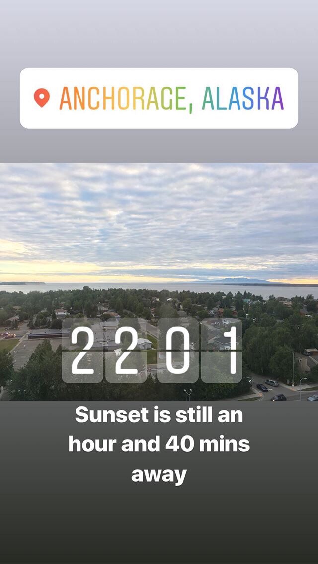
A mid afternoon flight from Seattle arrives in Anchorage 3 and a half hours later. Having lost another hour by moving timezones (now 9 hours behind the U.K.), it was around 7.30pm before I arrived at the hotel. After checking in I decided to stretch my legs with a walk around downtown Anchorage. Not a whole lot to see to be honest, and I didn’t really expect there to be. For the most part, Anchorage is a way into the state. The most striking thing for me was the daylight. I headed back to the hotel around 9pm and it could have been the middle of the afternoon.

Trek America trips start at 7.30am in the morning (which differs to G Adventures which generally start in the evening). After meeting the group (6 other travellers plus Sam, our tour guide) we did the usual admin and introductions before heading south to Seward.

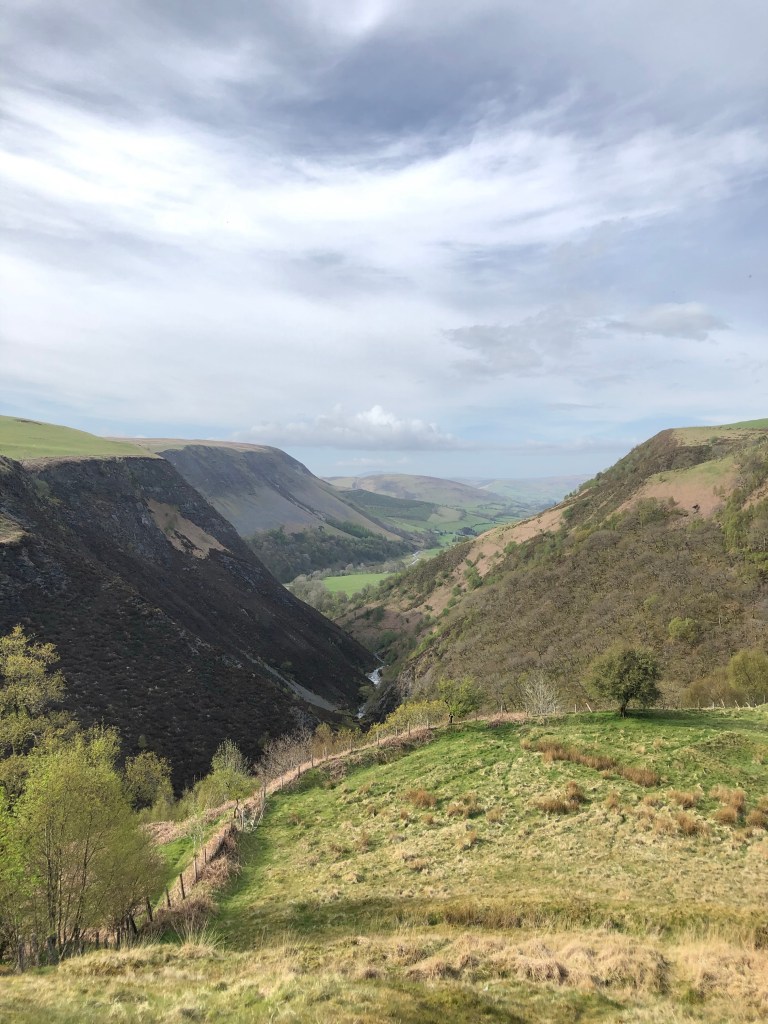
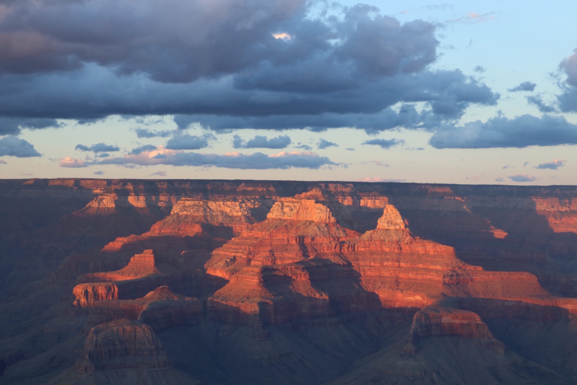
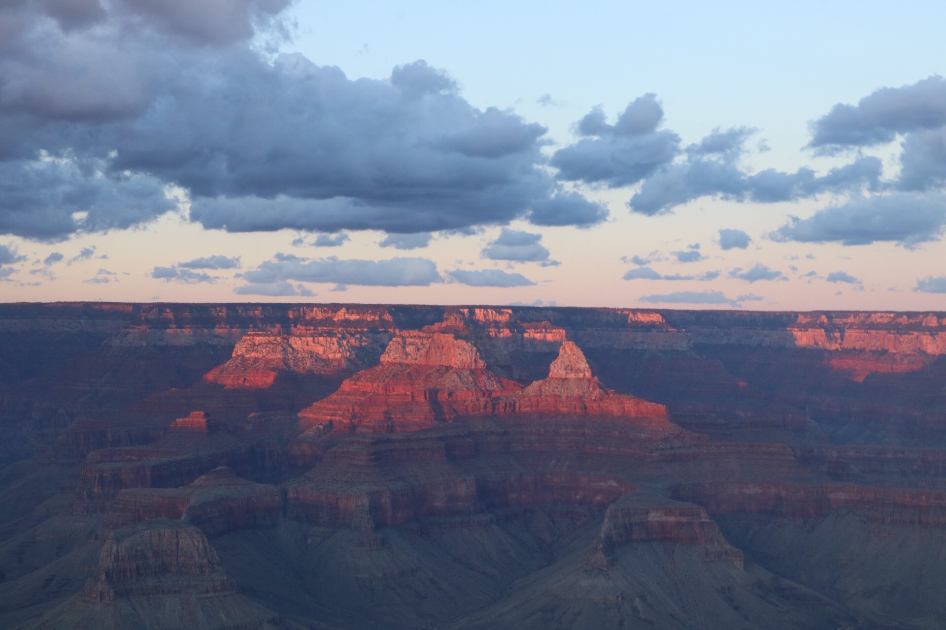
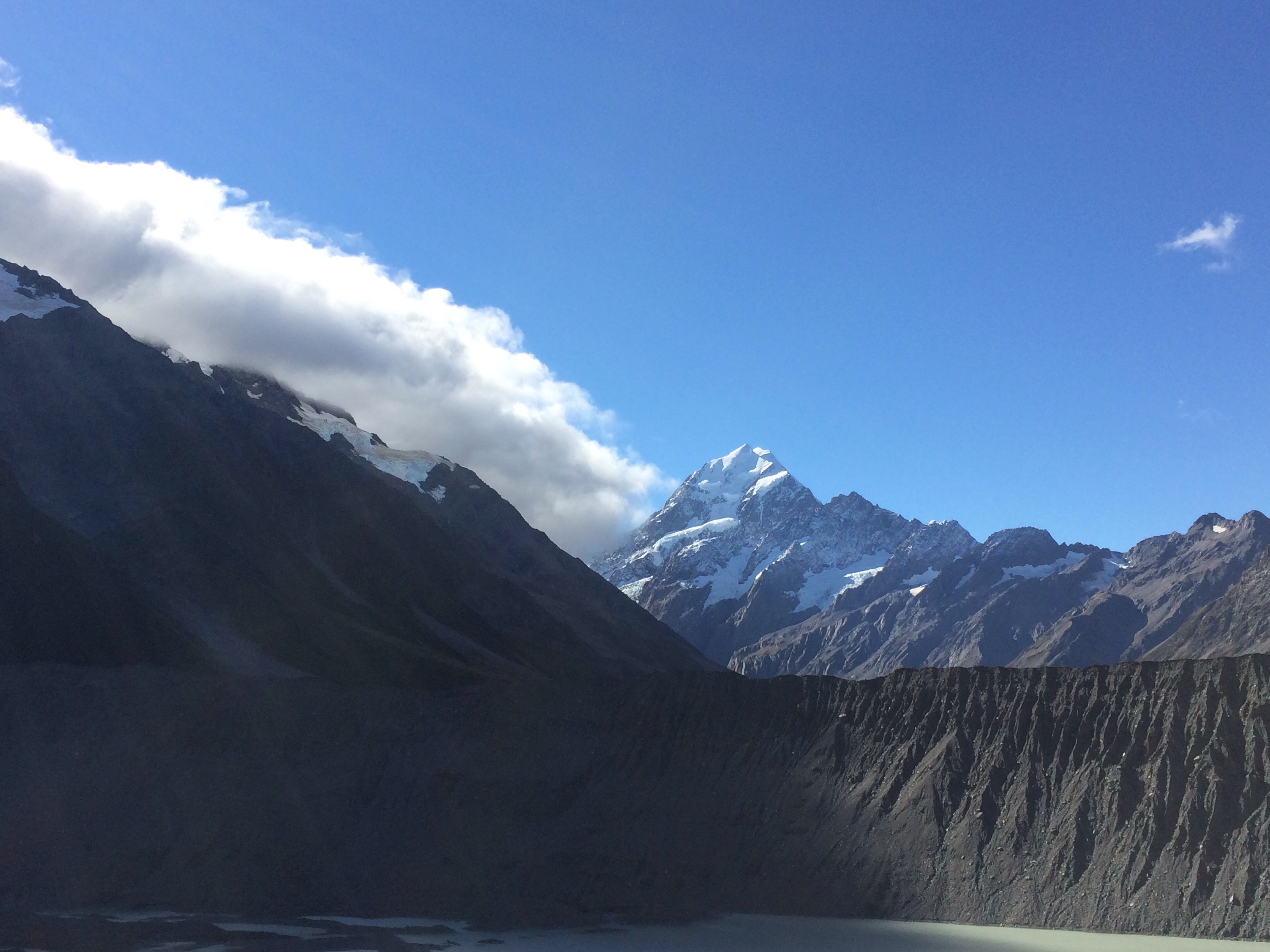
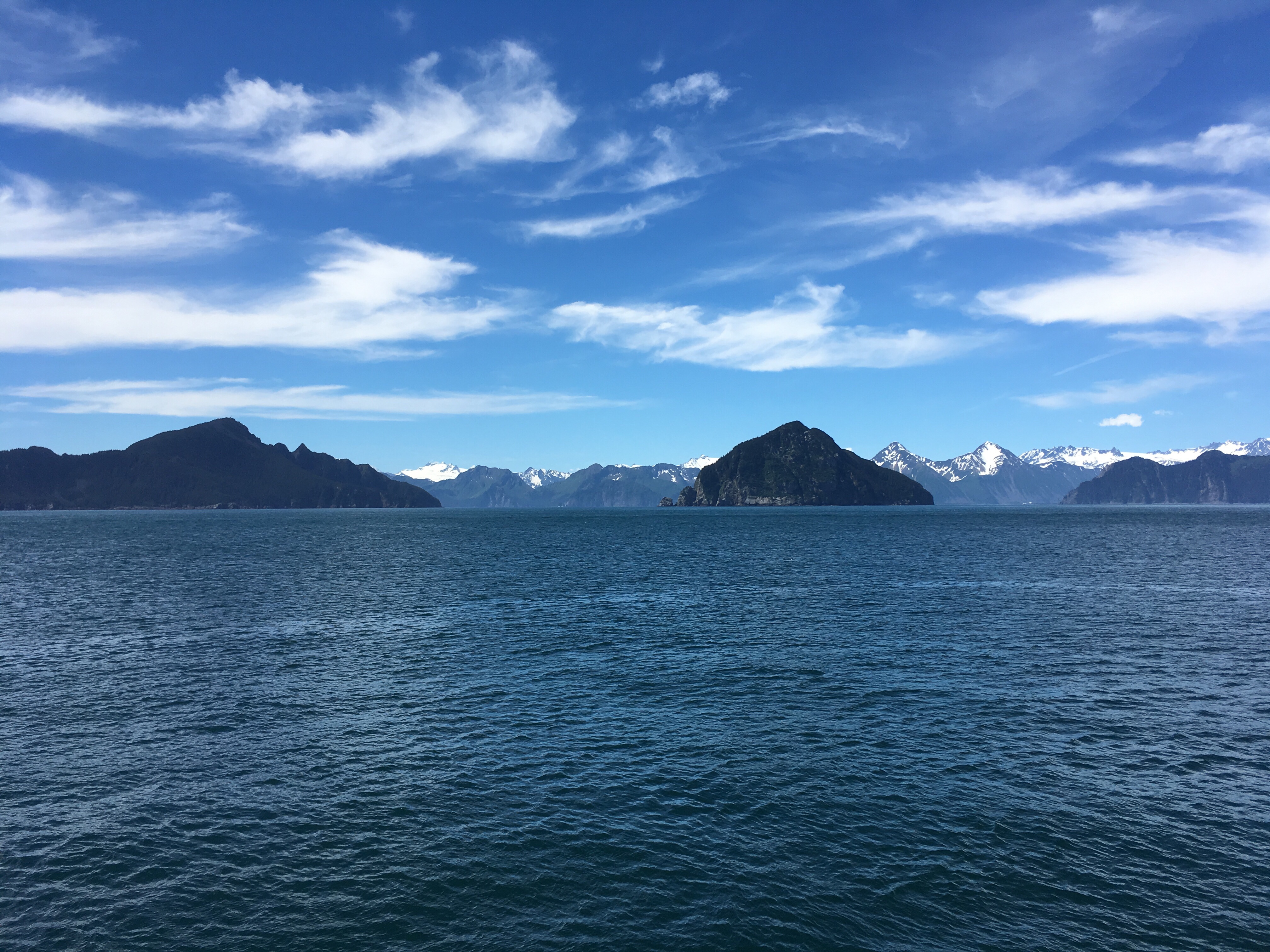
The drive down from Anchorage to Seward is a couple of hours, and is insanely scenic. It reminded me of Fiordland in New Zealand. There were lakes on one side of us and hills/mountains on the other side. We arrived in Seward around 11am and after grabbing some (very expensive) lunch from the local supermarket, we then got on board a boat for an afternoon of cruising around the Kenai Fjords. We were so, so lucky with the weather, even in summer blue sky and warm temperatures are relatively rare in these parts.

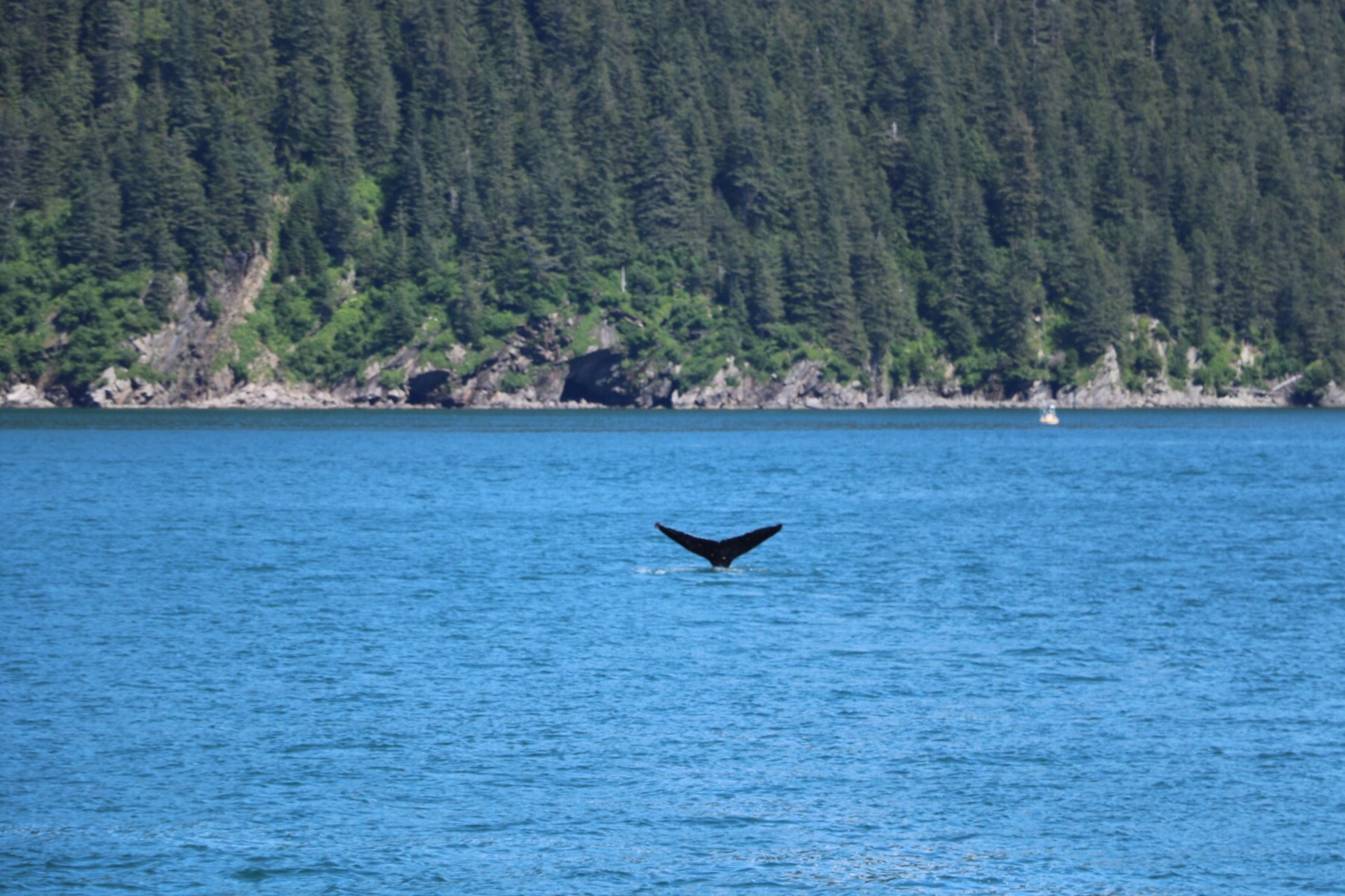
Aside from the epic scenery, we were also hoping to see lots of wildlife. We saw lots of birds (I have entirely forgotten what most of them were), as well as sealions and then eventually we saw a humpback whale. Money shot:

We stayed in a hostel in Seward where I managed to choose a bunk with a particularly saggy mattress. We went out in the evening for out first group dinner, followed by a couple of drinks in the first of many bars on the trip which had dollar bills covering the ceiling.

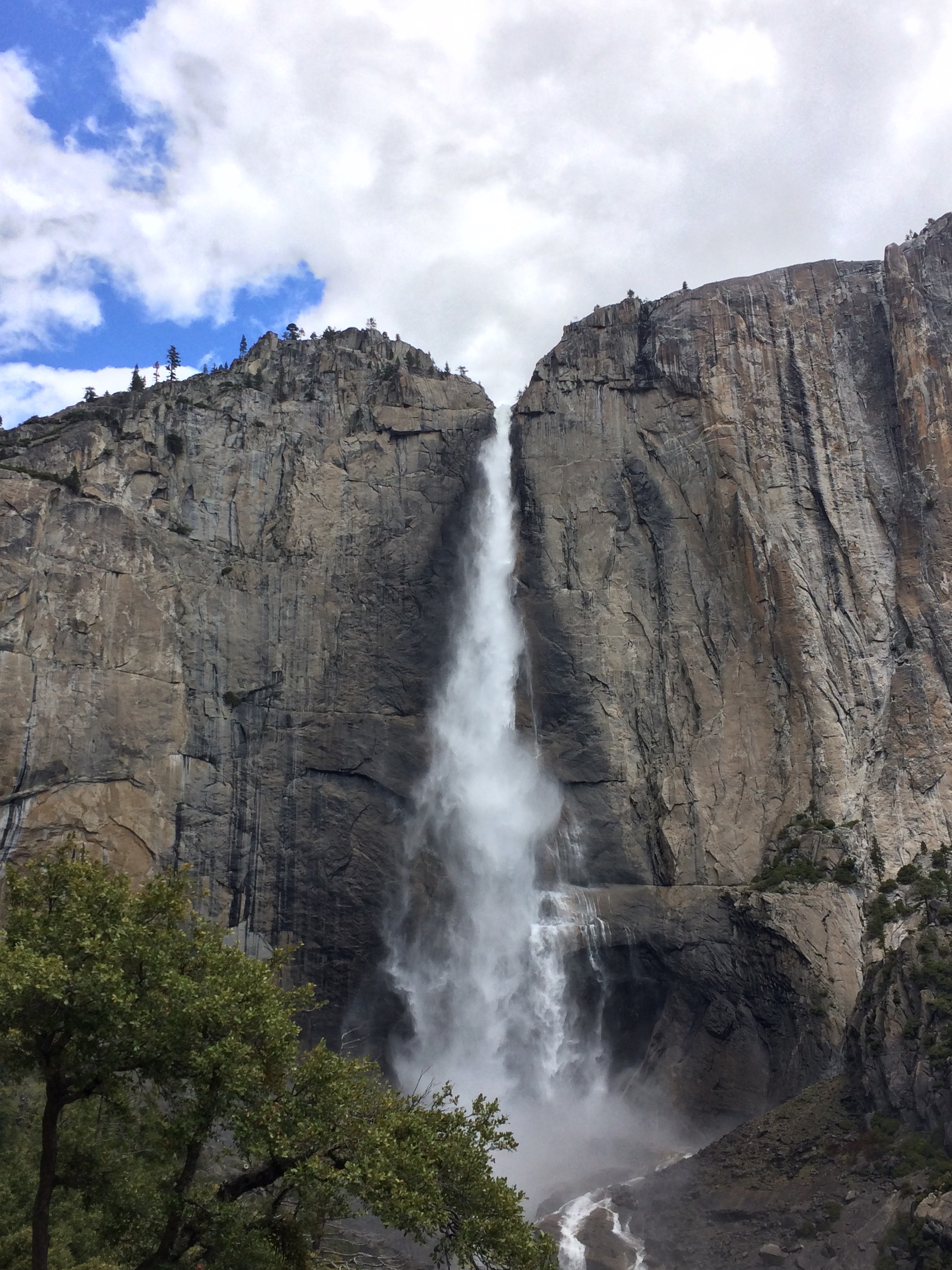
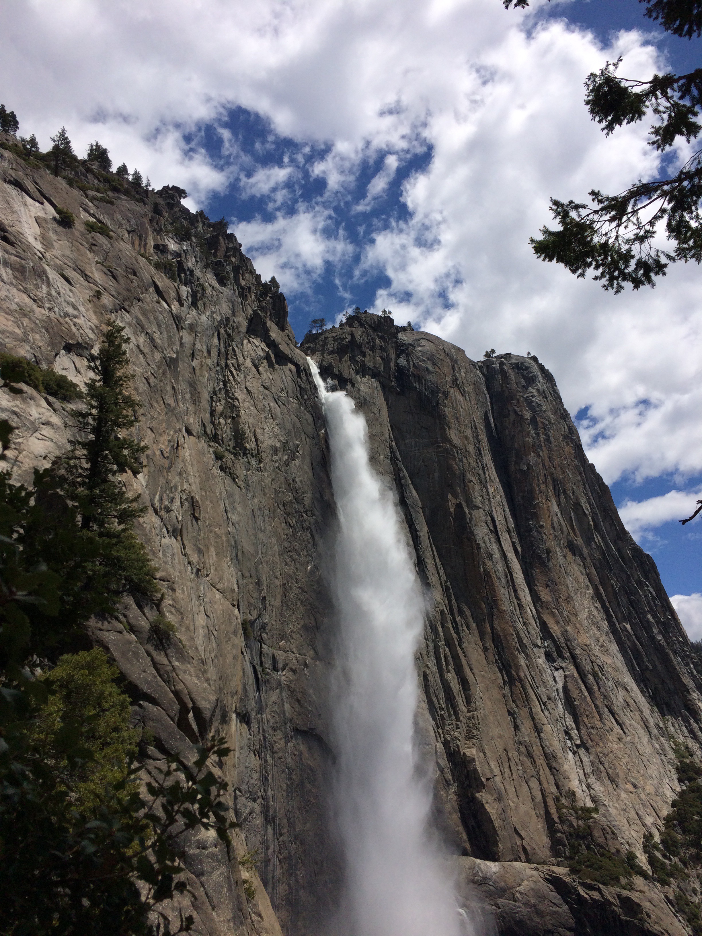
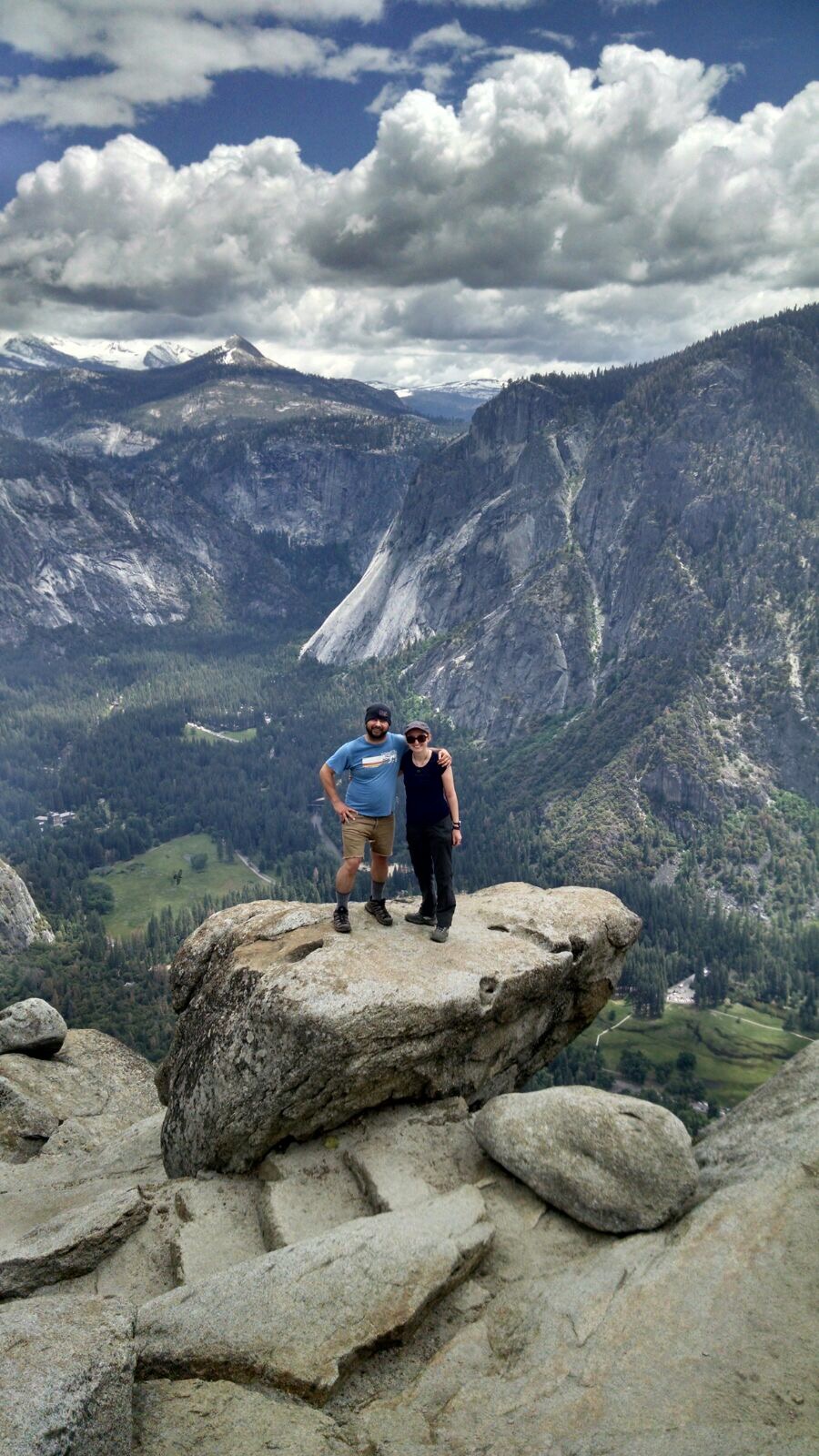
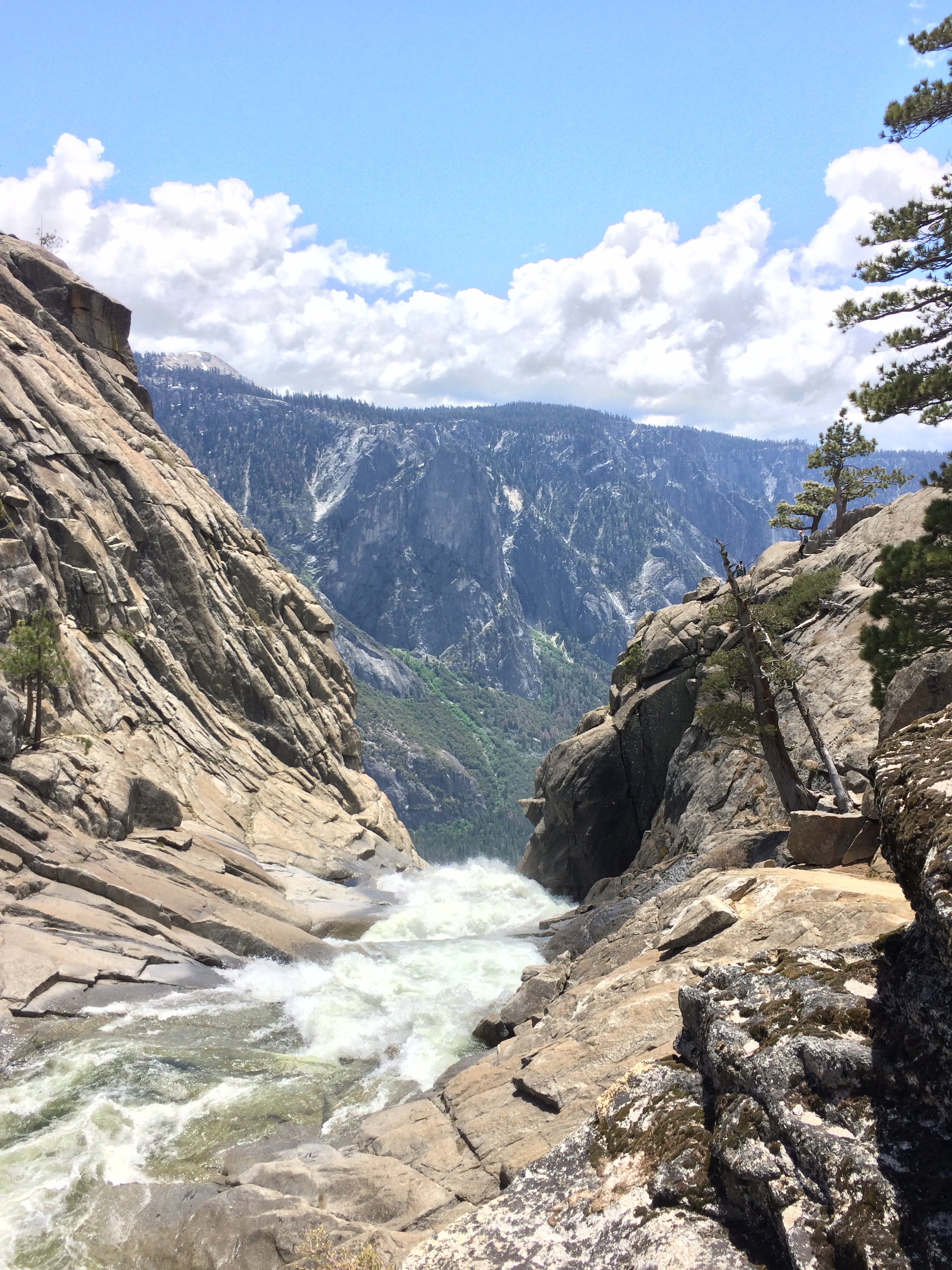
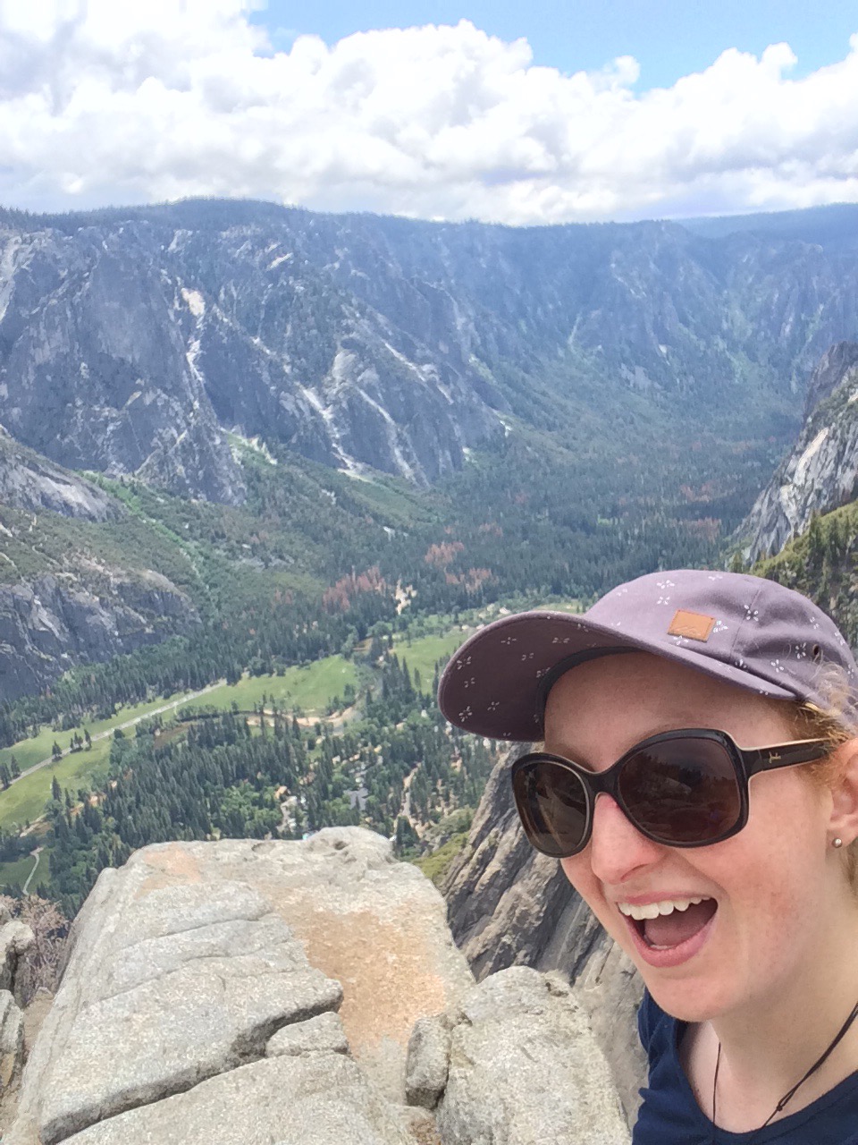
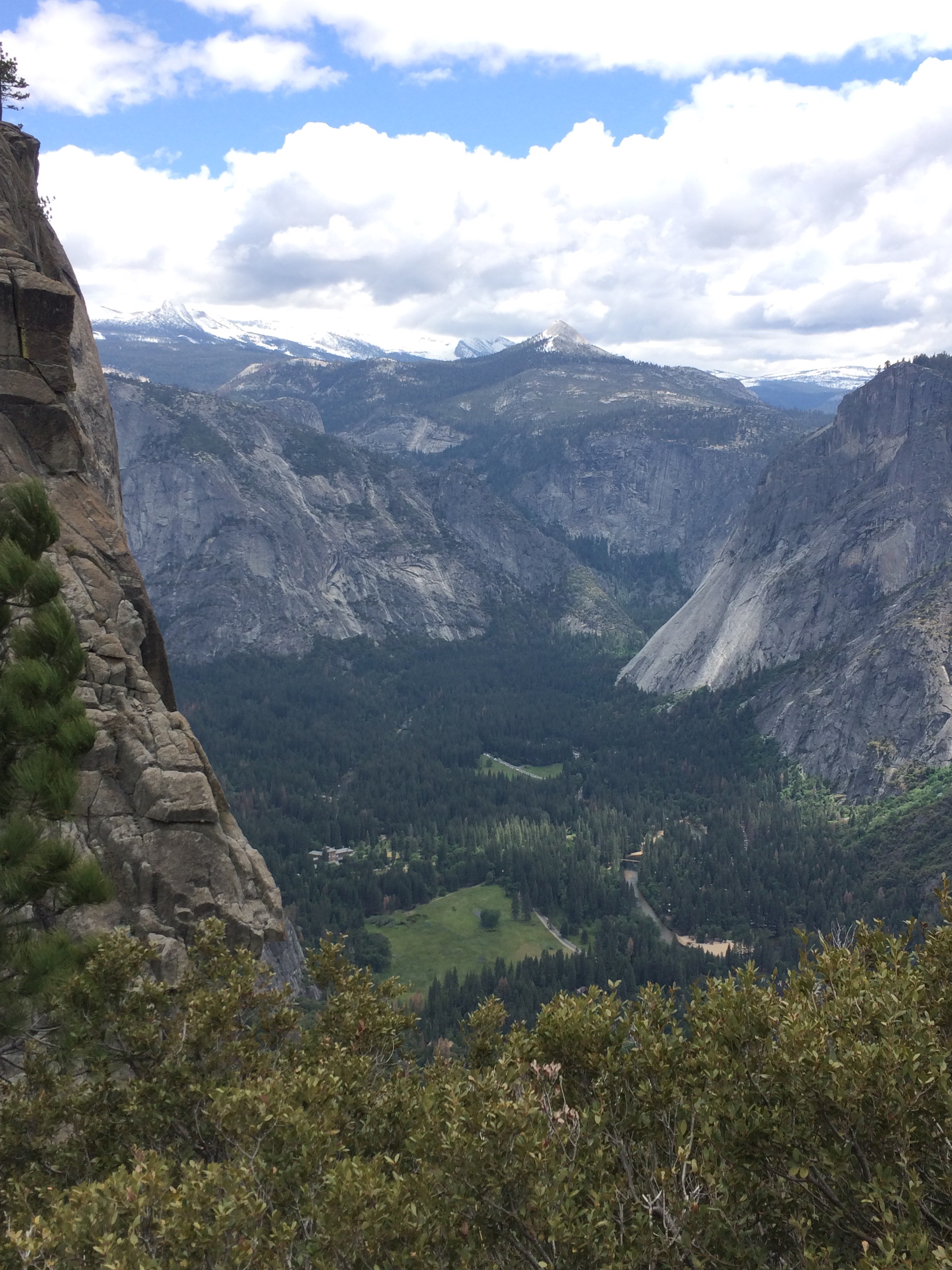
The next day we went to the nearby Exit Glacier. I did a guided ranger walk for a couple of hours to a viewing point at the face of the glacier, whilst some of the others did a more strenuous hike up towards the Harding Ice Field.

In the afternoon we headed back to Seward and along with a couple of the group, I did a short hike around the 2 Lakes Trail and then I went to the aquarium. In the evening we did our own thing for dinner before having a few/lots of drinks in a couple of bars, chatting to the locals and stumbling back just before 1am…and it was still light!!

I had a slightly bleary-eyed start the next day and we were up early and on the road at 7am for the long drive day to Denali – around 375 miles. The weather, however, was perfect.

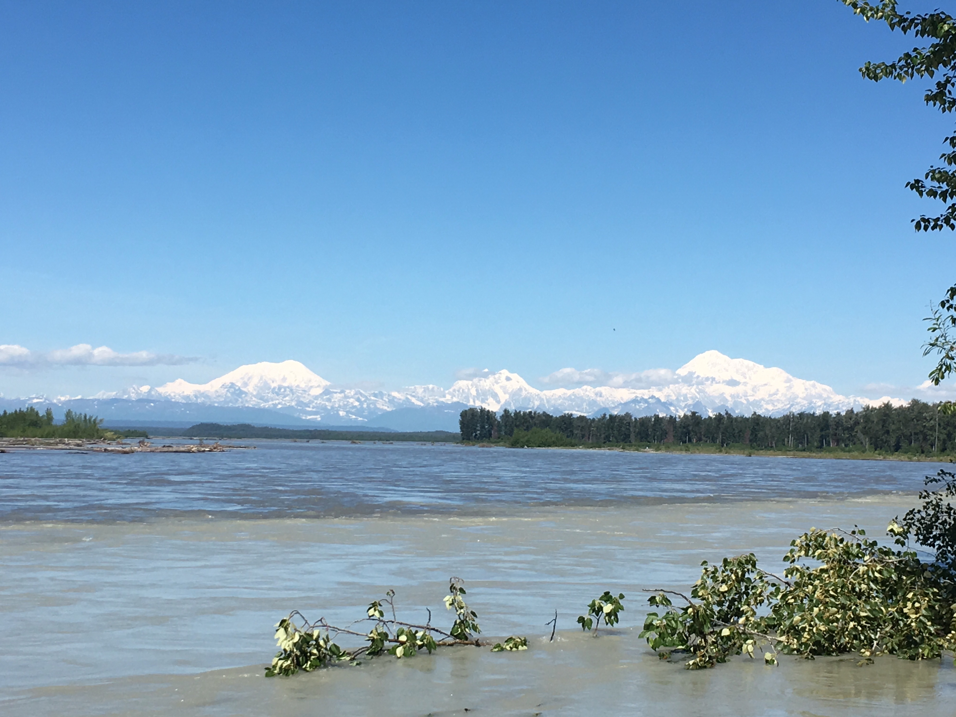
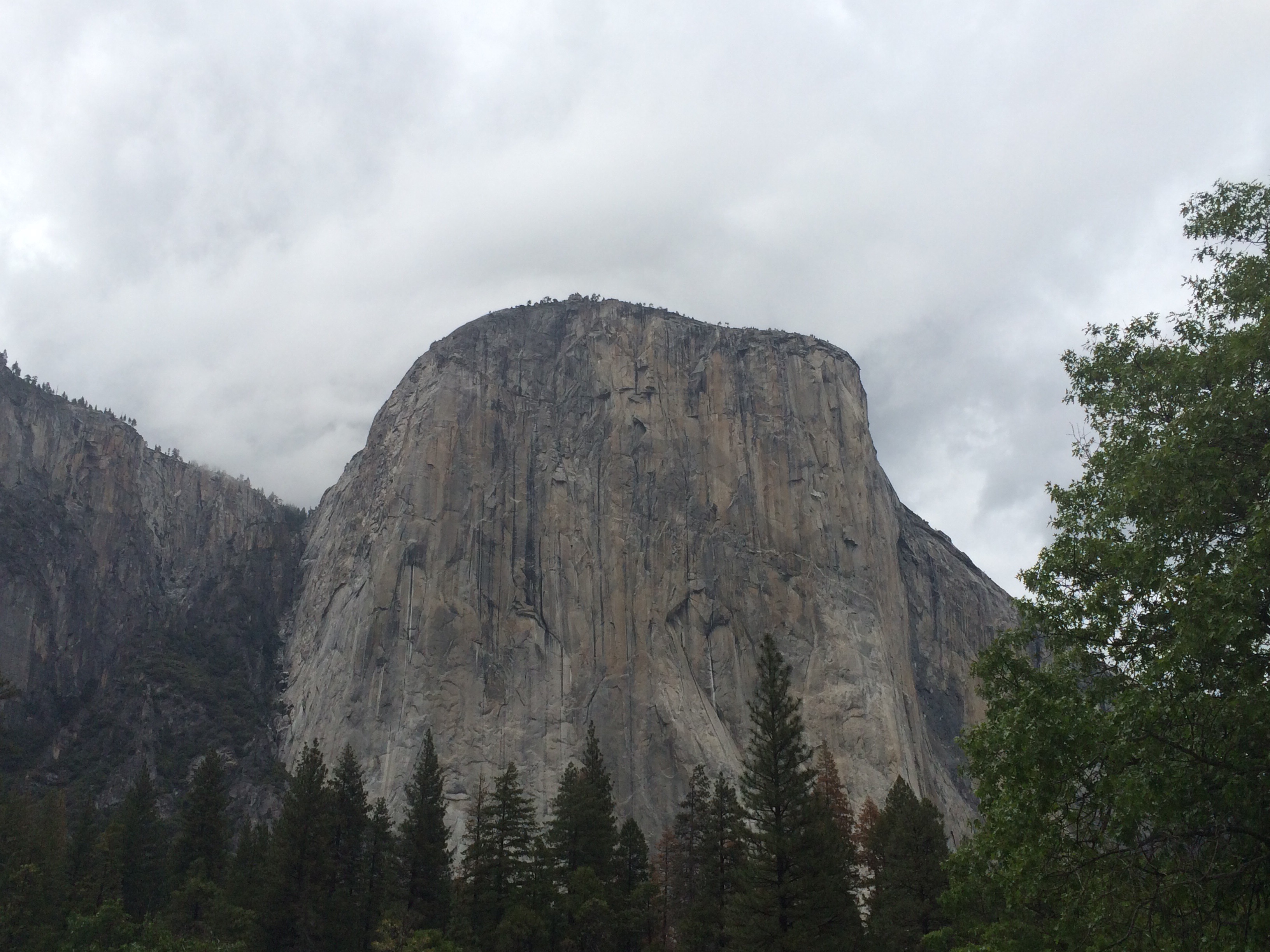
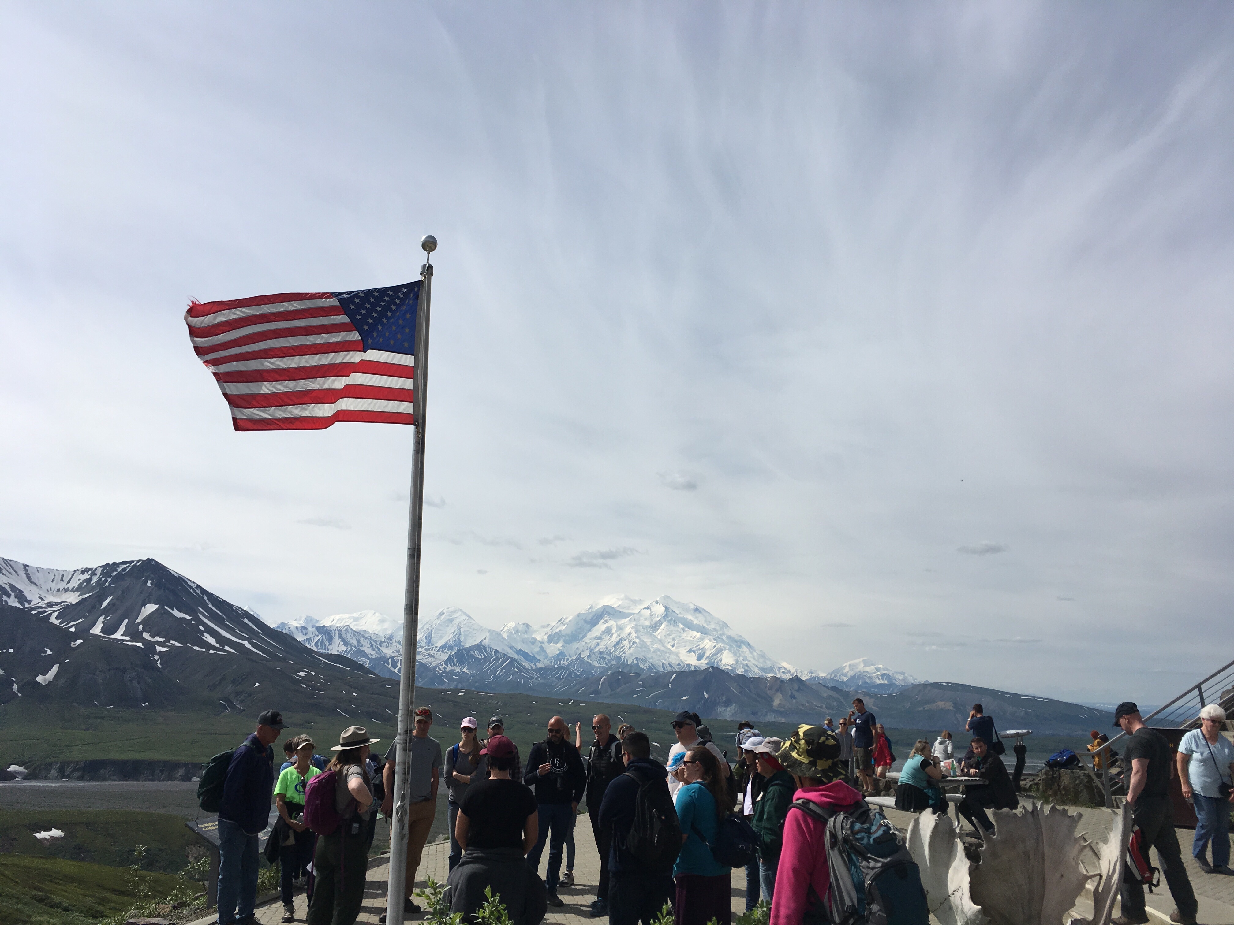
This picture was taken at the lunch stop in the town of Talkeetna, pretty epic view with Mount Denali on the right (tallest mountain in North America at 20,310ft, and it has a higher vertical rise than Everest from its base, as Everest rises from a plateau). On 2 out of 3 days you can’t see Denali because of the weather. Sam also said that though this was her 3rd trip to Denali this year, it was the first time she’d seen it, so I definitely feel that we were super-lucky.

We rolled into Healy around 5.30pm, where I had booked onto a scenic flight which would also land on a glacier. It was not a cheap excursion but it was totally worth the money.

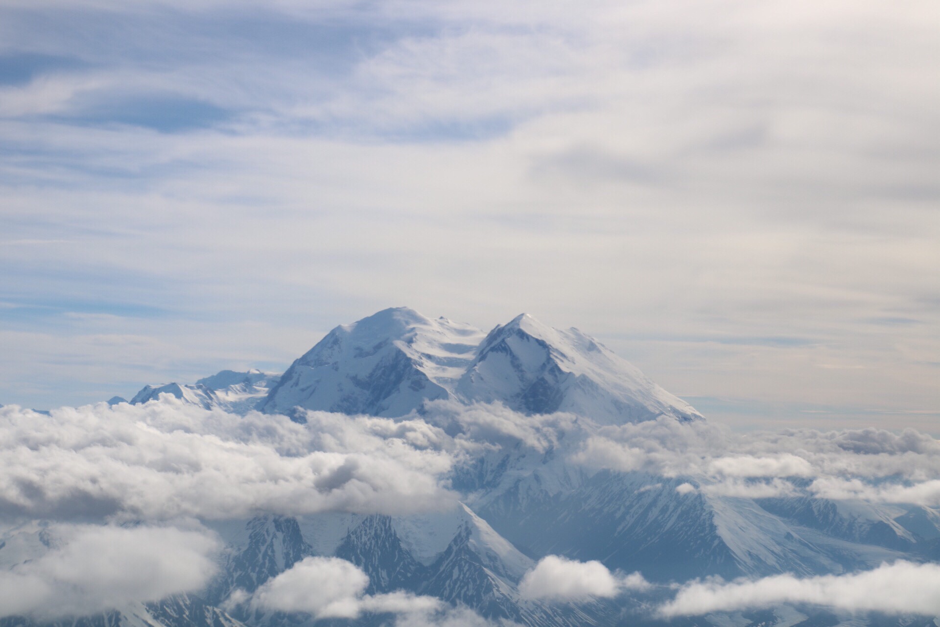
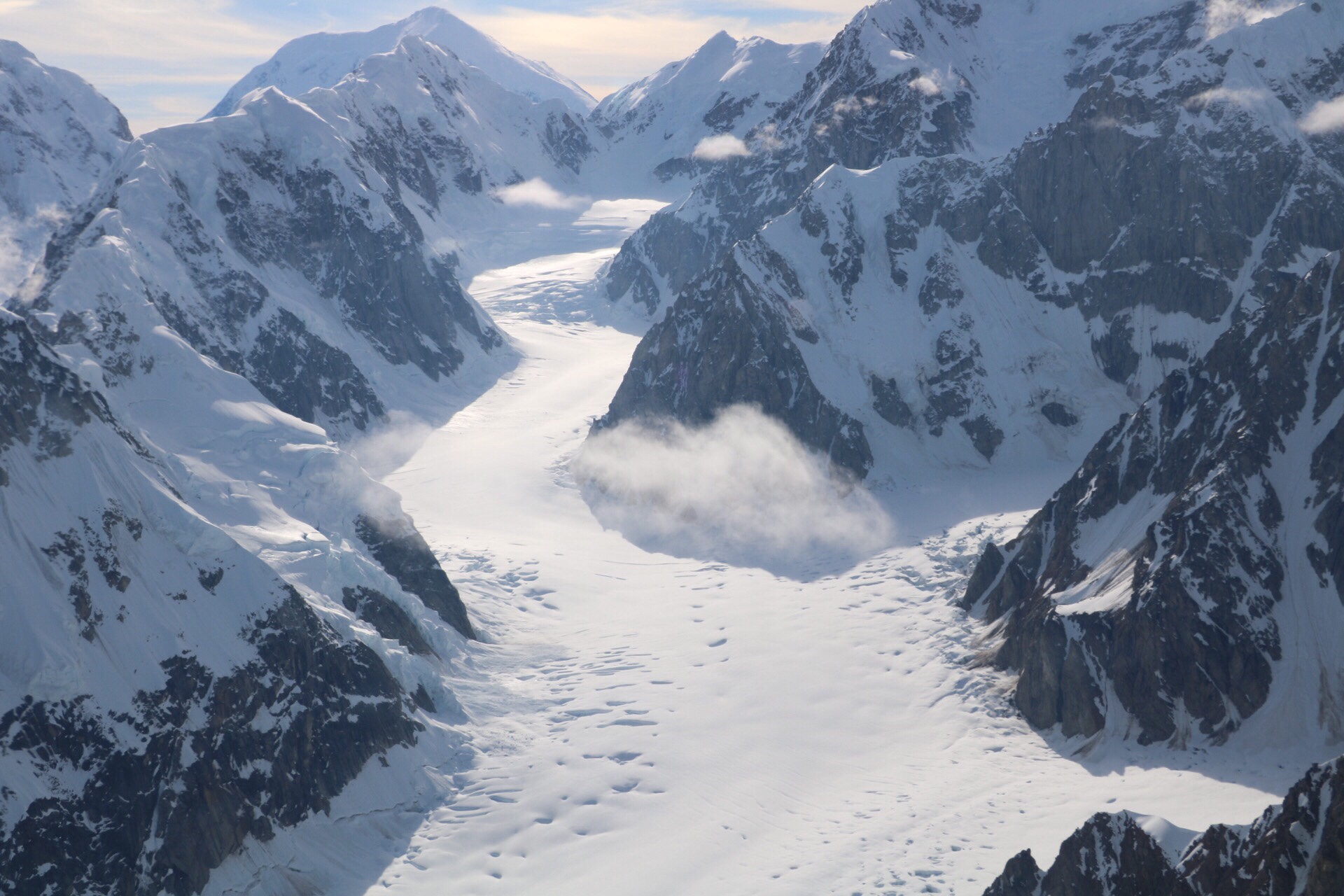
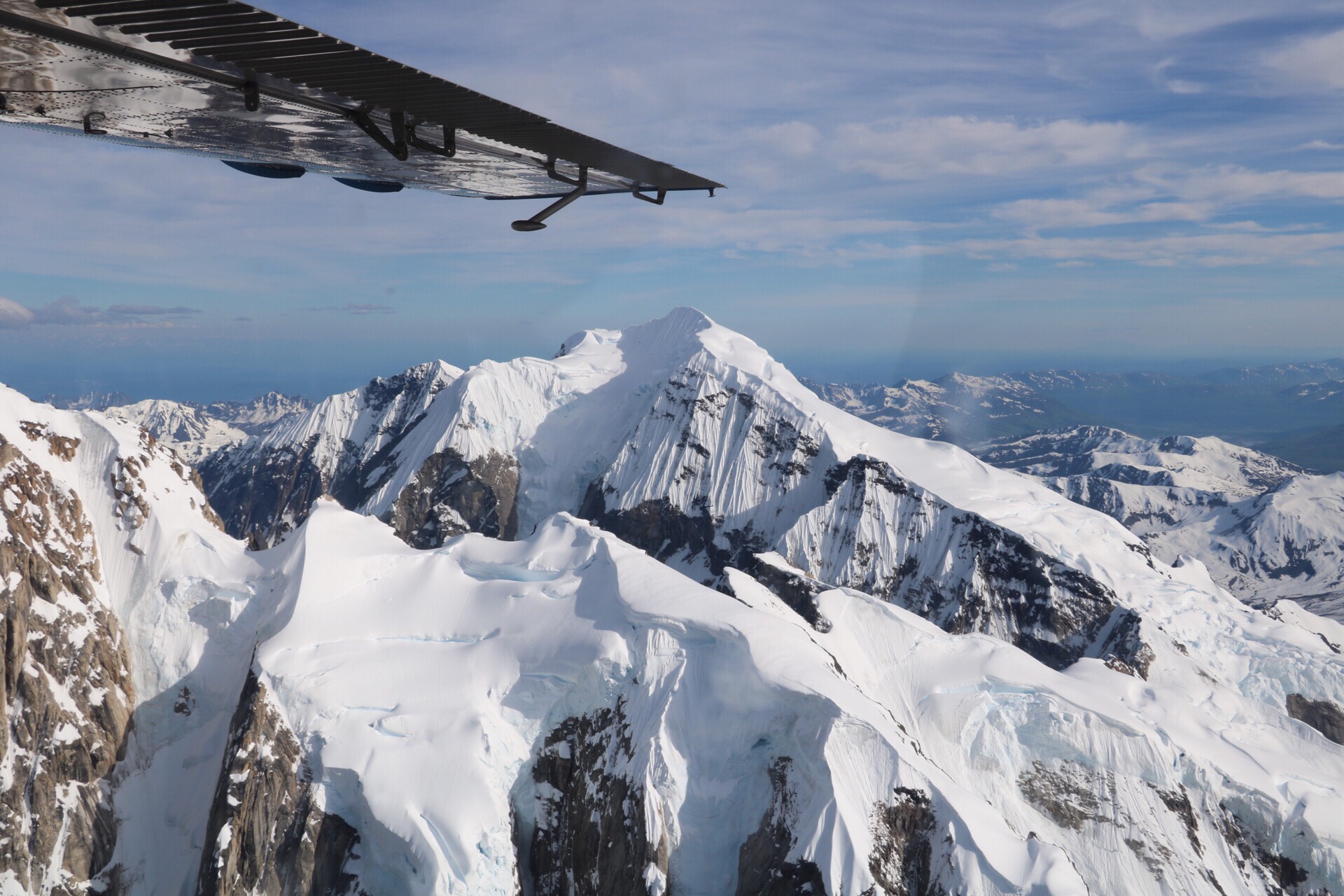
There were 8 passengers and the pilot on the plane, pretty cosy. I was right at the back but had a bonus with views out of both sides of the plane. The plane itself had skis on it so it could land on the glacier, which was an awesome experience.

After that we met with the rest of the group for a late dinner at 49th State Brewing. They definitely like their beers in this part of the world, there seemed to be quite a few local breweries around, though I had a nice glass of vino.

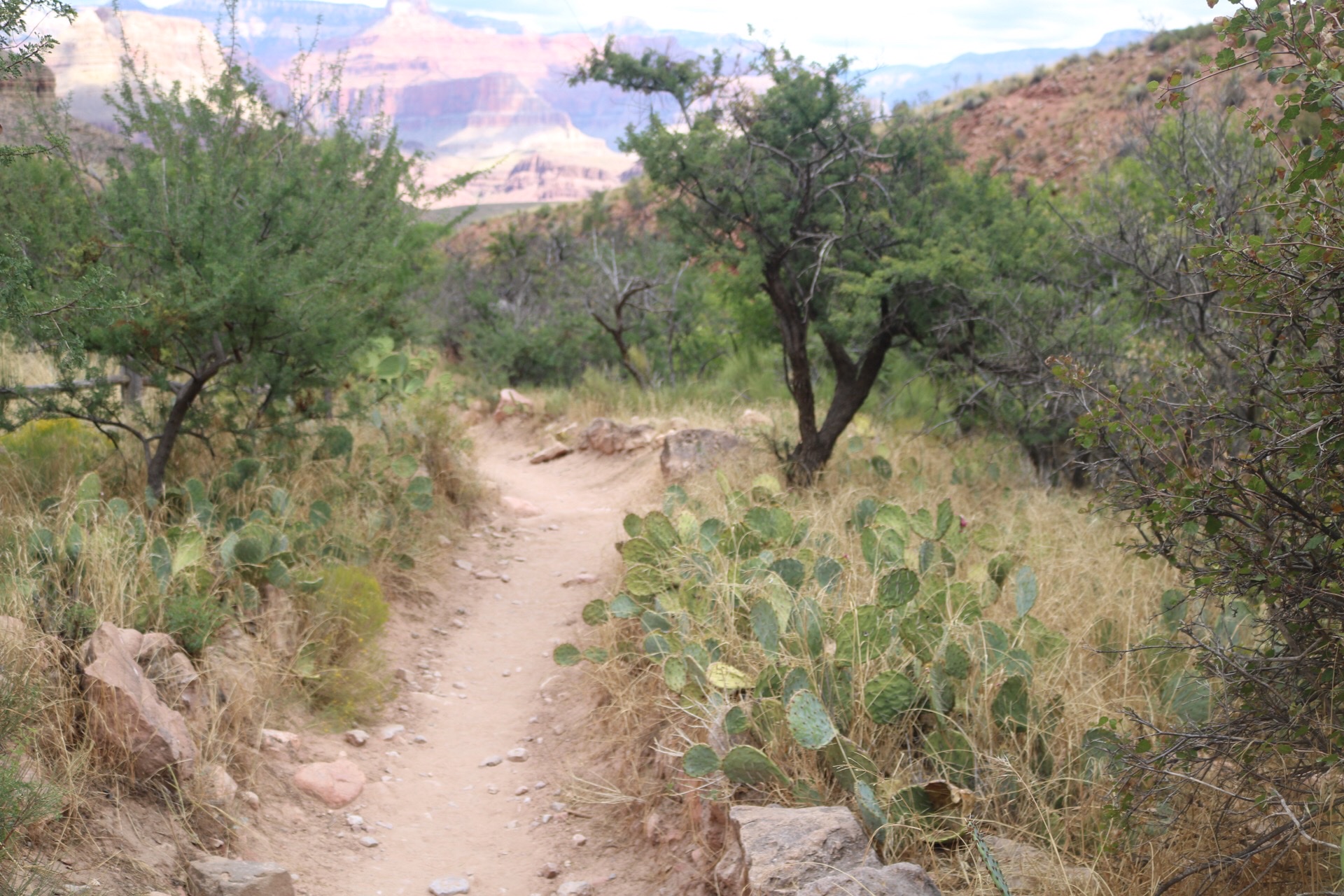
The next day (4th July!) we had a full day bus tour into Denali National Park. I think this is probably one of the most authentic wilderness areas I’ve been to. There is basically 1 road into Denali (at least from where we were staying), which is only paved for 20 miles, and private vehicles aren’t allowed beyond the first 20 miles. There are very few maintained trails and you are encouraged to go and wander (what the Americans term ‘backpacking’, though you’ve gotta be aware of the wildlife).

The bus took us out 66 miles to the Eielson Visitor Center and it took about 4 hours to get there. We made rest stops as well as stops for wildlife spottings. On the way out we saw caribou and some grizzlies.

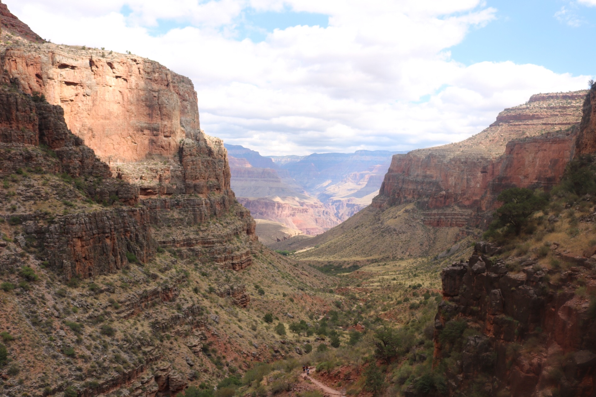
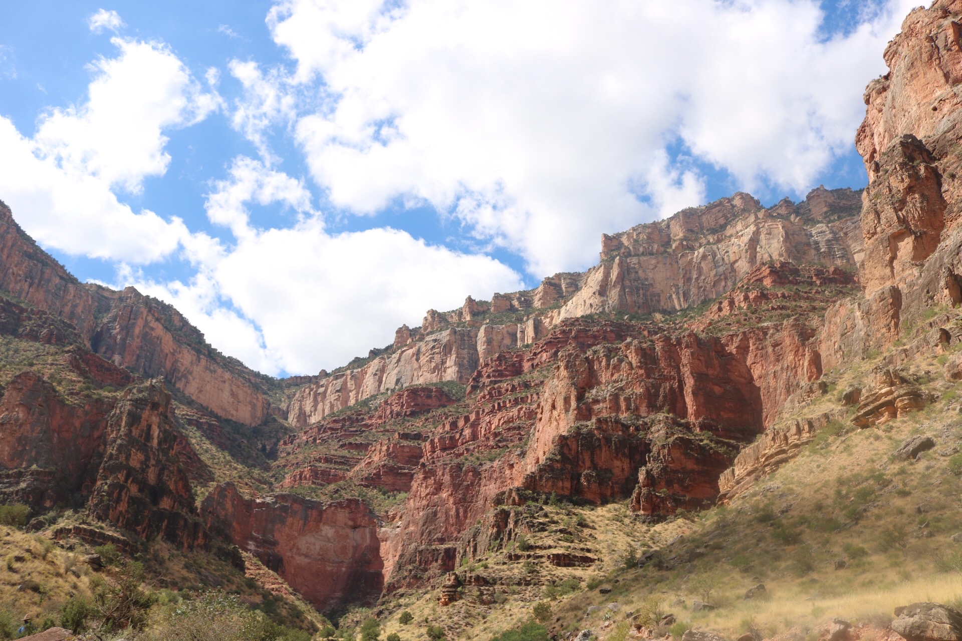
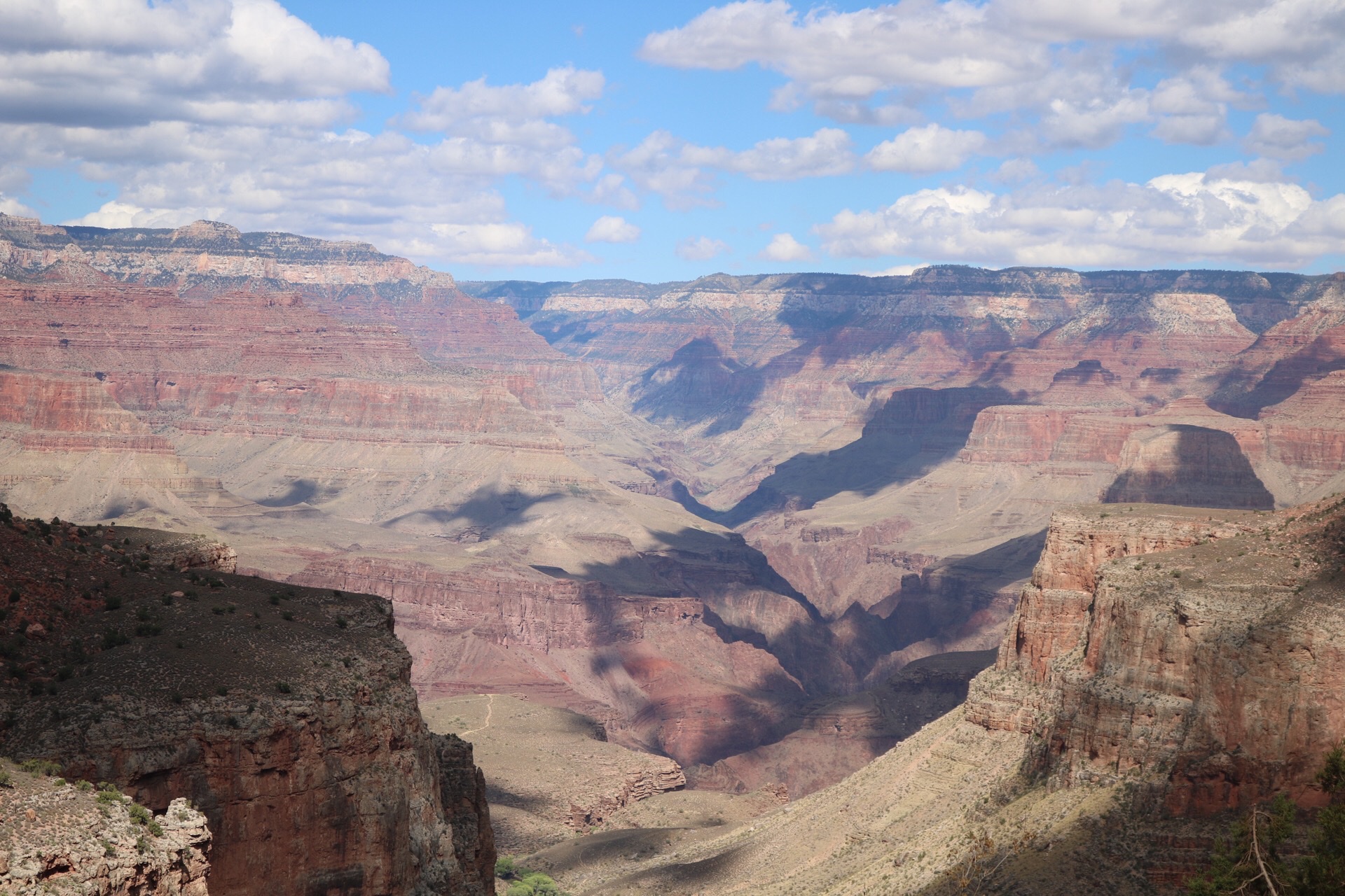
This is the amazing 4th of July view from the Eielson Visitor Center

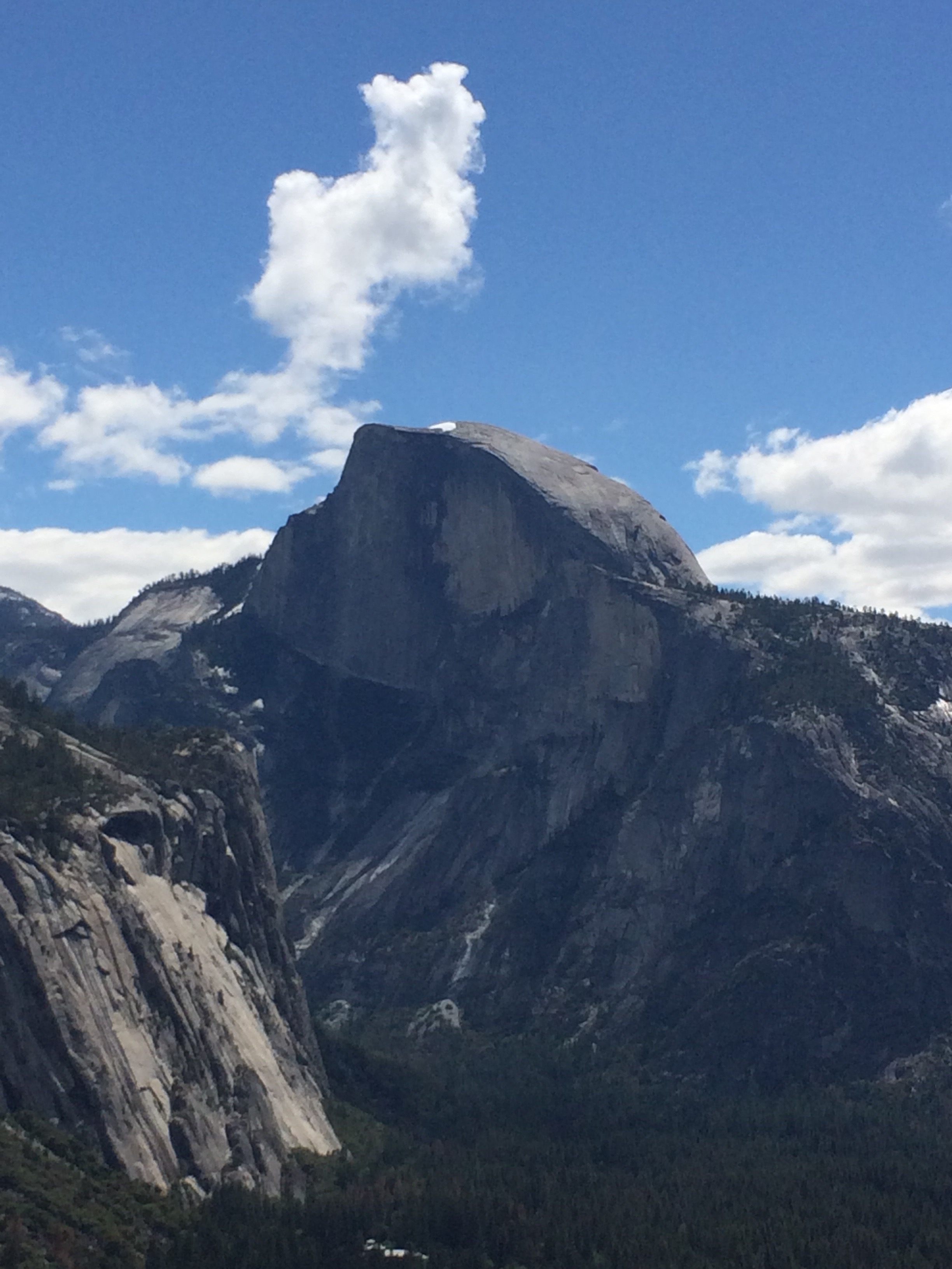
We did the Alpine View hike at the Visitor Center, where I was lucky enough to see another sow and her cubs coming down the hill. More epic views at the top:

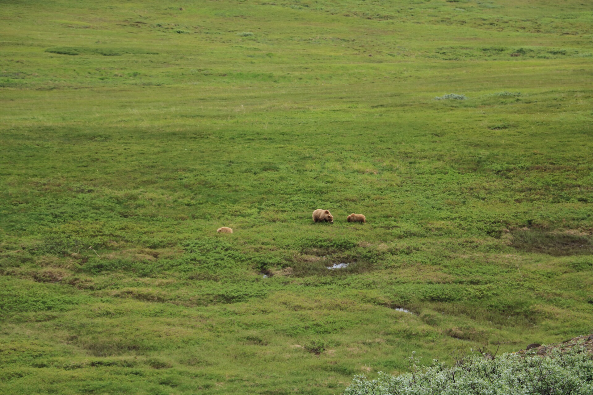
On the bus back we saw loads of sows and cubs, we seemed to be stopping every 20 minutes for sightings, which was really amazing. In contrast to the bears I’ve previously seen in Yellowstone, we seemed to be closer to the bears in Yellowstone. I have a whole heap of photos on my camera which at first glance are just photos of green hillside, but if you zoom in the bears are there – somewhere! In Yellowstone, with a less good camera, I have clearer photos of bears. But it is still really exhilarating to see bears in the wild.

We also saw a moose right at the end of the trip back. Moose are enormous!! The next day back at the park entrance there was a moose and her baby moose casually wandering in the car park! We essentially had a free day on the second full day in Denali. I decided to do some of the shorter trail hikes near to the park entrance Visitor Center. The weather was a bit rainy in the morning and I was glad for my full wet weather gear! Some of the group went rafting instead, not really my cup of tea.

The next morning we had a sled dog demo in the park. Denali is one of the few places where huskies work in the winter, to patrol the park and carry supplies on sleds. I can hardly imagine what this place is like in winter, covered in snow and blanketed in darkness. It would certainly be a different experience to be there in the winter!

After the demo, it was time to head off to our next stop. We were heading east down the (unpaved) Denali Highway to Maclaren River Lodge in the Alaskan Range. It was another long drive, but with more great scenery. Canoeing was an option here, but I was the only one who decided against it, and instead I enjoyed a couple of glasses of vino.

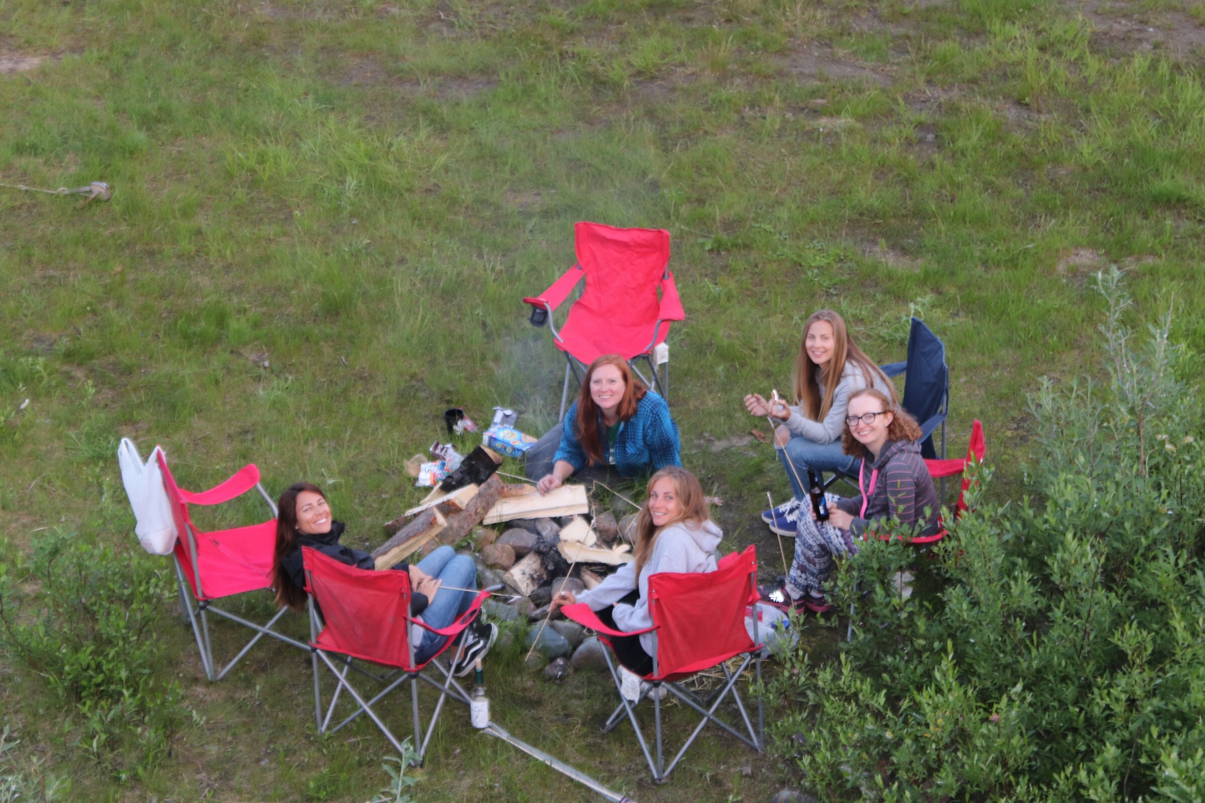
Once the rest of the group made it back (not all of them dry…) we had dinner and then had a bonfire and made s’mores. S’mores are classic American campfire snacks, toasted marshmallows, and a slab of Hershey’s chocolate sandwiched between 2 Golden Graham crackers – a proper sugar hit!

The next morning we had a short hike quite near to the lodge, and then continued along the Denali Highway towards Wrangell-St-Elias National Park. This is the largest national park in North America. It’s the size of Switzerland, and the main town within the park, McCarthy, is accessed via a 60 mile dirt road. It’s quite hard to imagine the isolation of these communities, especially outside of the tourist season. We arrived at 6.30pm on a Saturday evening, and after a quick shower we headed out to sample the local nightlife. There was live music in the Saloon to enjoy, as well as some interesting people-watching.

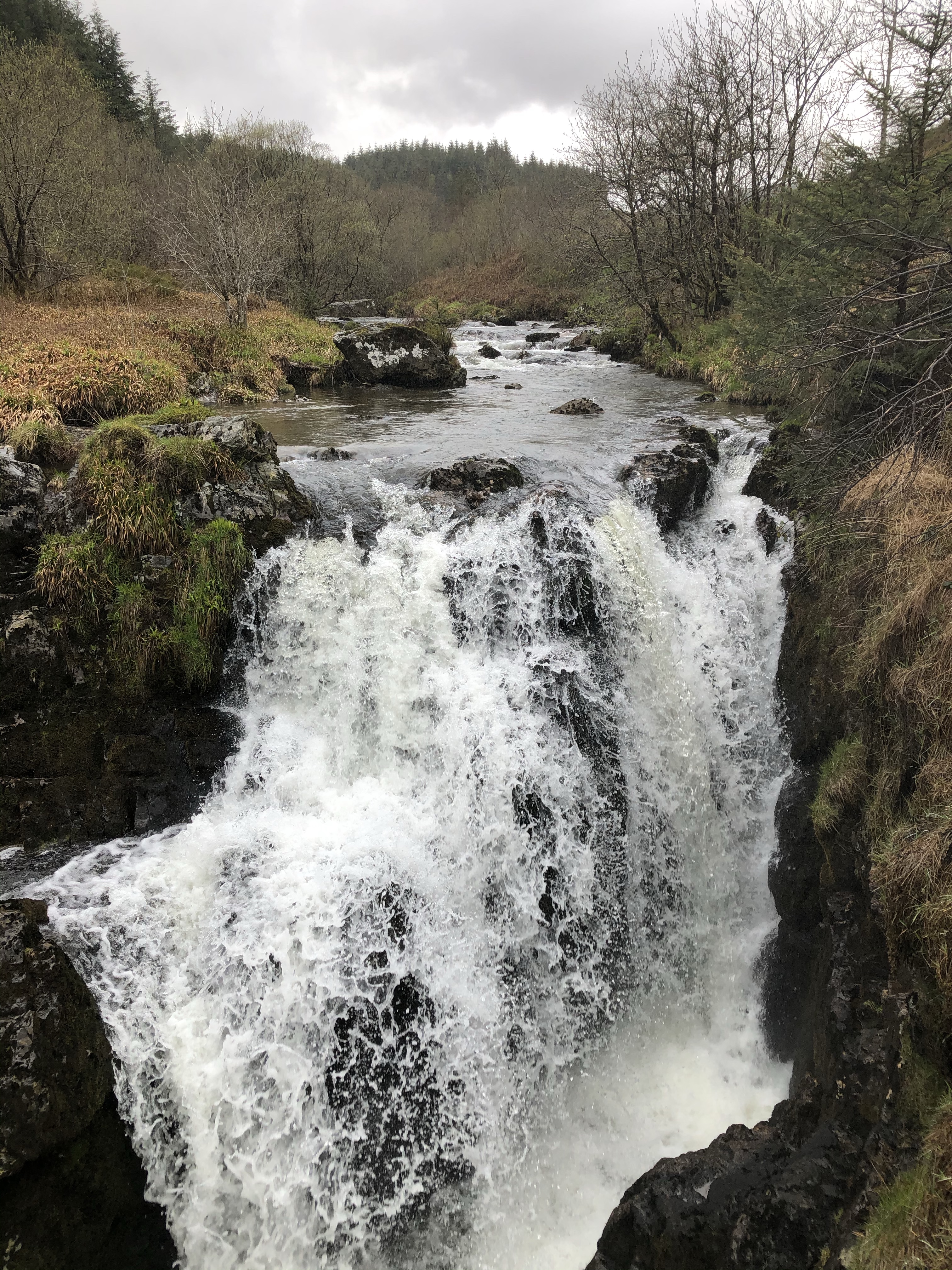
The next day the only thing to do was to get out onto the glacier. The options were a full day glacier hike or ice climbing. I opted for the glacier hike and after being fitted out with crampons which we would wear once on the ice, we headed off on the 2 mile hike to the face of the glacier. In contrast to other glacier hikes I’ve done which have largely followed set routes, this one felt much more like we could roam free (within reason, i.e. avoiding any precipitous drops!). And by ‘roam free’, I mean that I felt that our guide wasn’t following a pre-determined path, but was taking us to look a interesting features on the glacier.

We hiked about 6 miles on the ice, and because we were constantly moving, it didn’t feel as cold as you might expect.

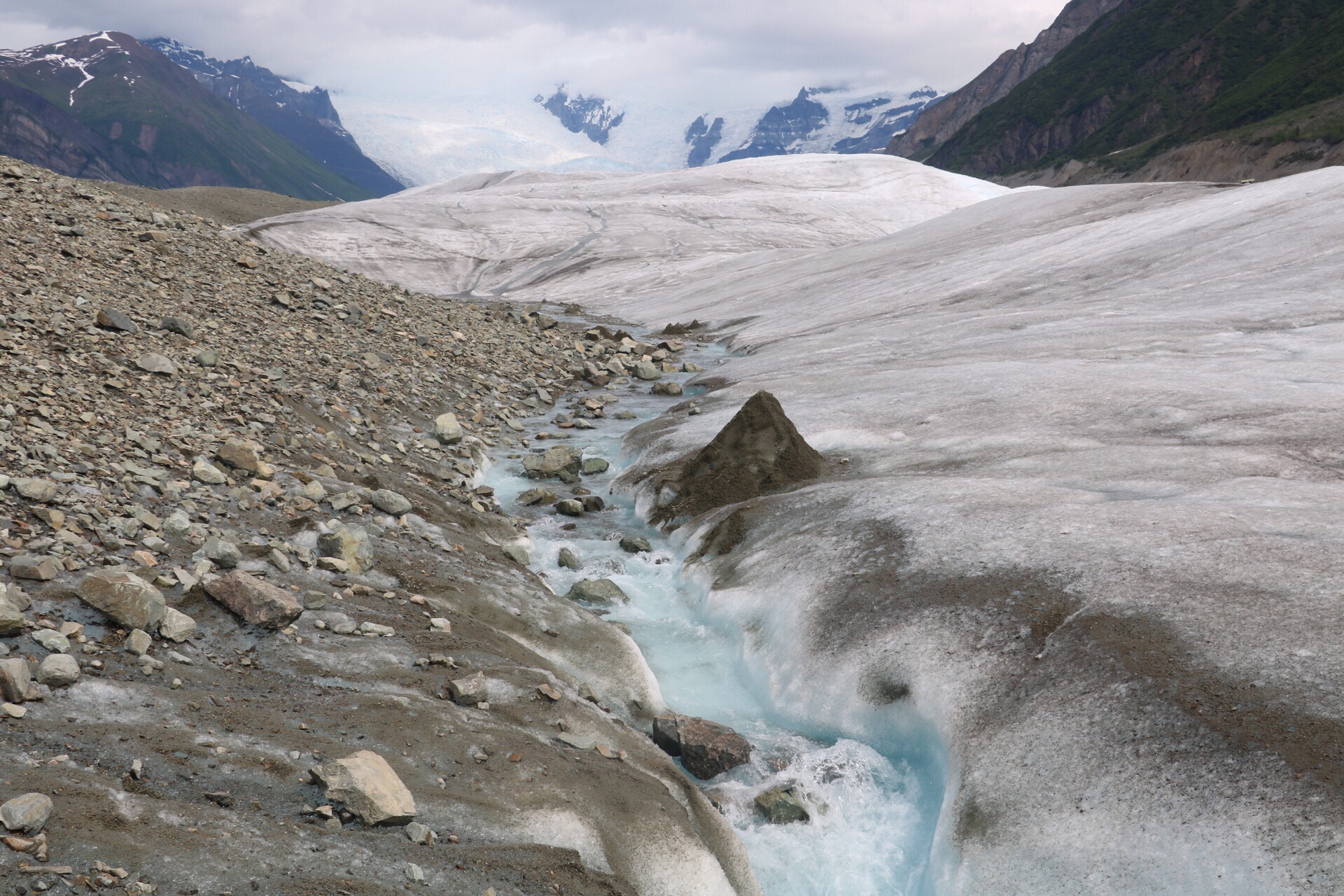
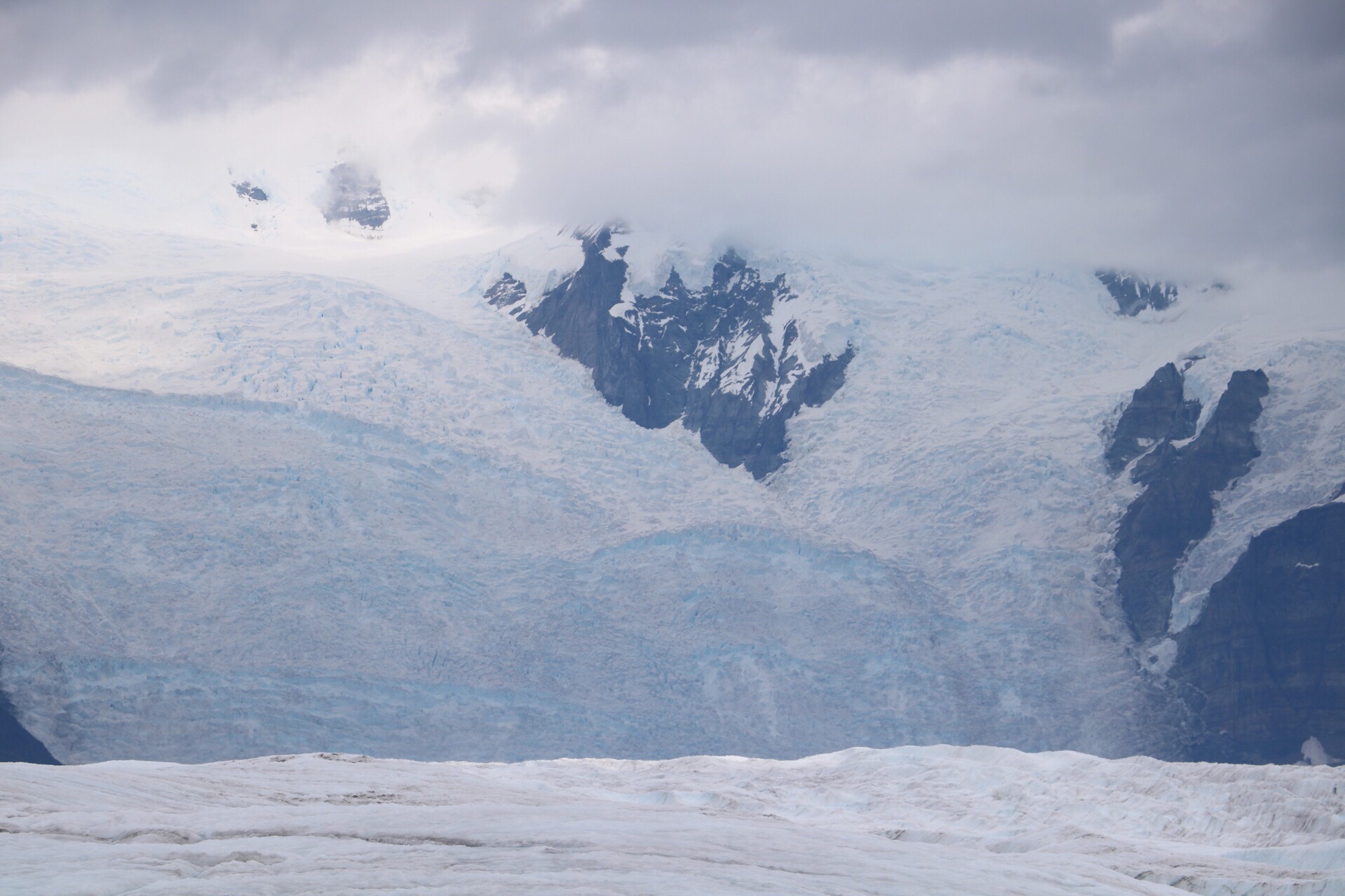
The blues that you see on the glacier are so intensely blue, the photos don’t really do it justice.

We returned in the late afternoon, and on the drive back to McCarthy from Kennicott, as we turned a corner in the road, a black bear was right in front of us! It looked at us for a few moments before disappearing into the bush. Really cool to see up close!

The next day was the last day of the trip, and a long drive back to Anchorage. Firstly back down the 60 mile dirt road through the park, and eventually onto the paved highways. We rolled into Anchorage at 6pm and said our goodbyes as we weren’t all staying in the same hotel.

A reasonably early night followed for me as I had a 4am alarm for the long journey back to the U.K.

So, what were my overall impressions of Alaska? First off it is beautiful. The scenery and wildlife are out-of-this-world. The locals are friendly, and in the summer there is near-constant daylight which means plenty of time (if you can hack it) for exploring. Pack for all seasons, it’s unlikely to be hot and the weather can change pretty quickly. Things to be aware of, firstly the prices – it’s expensive in Alaska, naturally because it’s pretty remote up there. On the plus side, there is no sales tax so at least you know that price you’ll pay once you get to the till. Secondly the nightlife is very low-key. You definitely don’t come to Alaska to party. And thirdly, the sheer size of Alaska – it’s huge. It’s 82 times larger than Wales. The furthest north we got was the Denali region, but there is another near-600 miles of Alaska before you hit the Arctic Ocean, and you’ll be lucky if those roads are anything more than a dirt track. It’s difficult to appreciate the remoteness of some of these places, and I can barely imagine what it’s like to be there in the constant darkness of winter. But all in all, definitely worth visiting.

Yosemite

Yellowstone and Yosemite were the 2 things I was most excited about for the northern part of this tour. I’d been to Yosemite before back in September 2013 when I did a Vegas/California road trip with the family. Unfortunately we were there during the Yosemite rim fire, and as we were staying in Mammoth Lakes to the east of the park, we were unable to get to Yosemite Valley. I was absolutely gutted at the time. We did get into the park on the Tioga Road from the eastern part but only as far as Tenaya Lake. The irony this time round was that Tioga Road wasn’t actually open. It is at a high elevation – over 9000ft – and still has snow on it.

We drove into the park from the western side and stopped off to check out some giant sequoia trees. These things are absolutely enormous. Kauri trees in New Zealand are big but sequoias are on a different level.


We then drove into the valley and had an awesome view of El Capitan and Half Dome.

  
We then drove on to see Bridal Veil Falls – the views kept getting better and better.

  
We then carried on to see Yosemite Falls – the tallest waterfall in the USA. 

  
We also stopped at the face of El Capitan and spotted people climbing up it. You have to be well equipped to climb El Capitan as it takes several days to scale it.

  
The next day was our free day in the park. There were several hikes available and I decided to do the Upper Yosemite Falls hike. It is 3.2miles to the top, with an elevation gain of 2,700ft. Yosemite Valley is already at 4,000ft so it was extra hard work because of the altitude.

It took 3 hours to hike to the top and was really tough going at certain points. I was the only person from my group hiking this route (some of the others hiked the Vernal and Nevada Falls route), but most people from the camping group did the hike. (Side note here – I am doing a lodging tour i.e. staying in hotels and hostels, but there is also another Trek group doing exactly the same route but they are camping instead).

JD, our tour leader, also did the hike and was great at keeping me going. There were some pretty awesome views on the way up:


And also from the top:


Yosemite Valley looked incredible. The photos really don’t do it justice.

After stopping for lunch at the top, and with some ominous weather looming, we headed back down. It only took 1 hour and 50 minutes to get back down, but it seemed to go on and on. My legs weren’t too bad afterwards but my left knee was complaining a bit! I was very proud of myself though and I’m glad I gave myself the challenge of doing this hike. It was tough but easier than the Tongariro Crossing (which I vastly underestimated) and the Inca Trail.

After grabbing a pizza dinner in Half Dome village, we went out to Tunnel View point to catch the last of the sun.


This couple of days definitely made up for the disappointment of not being able to see anything last time. I’m almost glad I missed everything last time because it made this experience so much better. Definitely the highlight of my USA trip so far.

Aoraki Mount Cook

I’ve just spent 2 and a half glorious days in Aoraki Mount Cook village and national park. The weather could not have been more perfect.

We left Queenstown early on Friday morning. The Remarkables mountain range had a dusting of snow overnight – it’s definitely Autumn now! After a stop in Cromwell for supplies (there are no shops in Mt Cook village), we stopped for lunch overlooking Lake Pukaki. The blueness of the lake is amazing.

 
We arrived at our accommodation in Aoraki Mount Cook village at around 2pm. Aoraki is the Maori name for Mount Cook, and means ‘cloud piercer’. In the afternoon we went for a walk along the Hooker Valley Track, which is a walk I’d done when I was here back in 2014. The weather was much better this time, and we got some awesome views of Mt Cook on the walk, which we couldn’t even see in 2014.


As the sky was so clear, we were treated to a fabulous view of the night sky in the evening. It’s probably the clearest I’ve ever seen the Milky Way, and we could also see Jupiter and Mars really clearly. The views of the night sky that I’ve seen on my travels really have been something else.
On Saturday I took a 4WD ‘Argo’ trip to the terminal of the Tasman Glacier.

  
I have to say that this was one of the most uncomfortable journeys I’ve ever had, 5km up a boulder-strewn gravel track, but it was an awesome view when we got to the glacier.

  
I then spent the rest of the afternoon at the Sir Edmund Hillary Alpine Centre, learning about the first people to ascend various peaks in the Southern Alps, along with watching a 3D short film on Mount Cook, and an interesting documentary on Sir Edmund Hillary’s ascent of Everest in 1953.

In the evening i had a vastly overpriced pint of cider from the bar at the backpackers. It was $11 – £5.50 – basically London prices. I won’t be making that mistake again!!

Today (Sunday) was another beautiful day. I walked up the Sealy Tarns track. This was quite challenging. Roughly 90 minutes of walking up steps, though I suspect fitter people could do it in around an hour. The views on the way up, and at Sealy Tarns lookout, were amazing.


It only took me 45 minutes to get back down, and even with about half an hour for lunch at the top, I was still within the suggested 3 hour time frame for the walk.

I also walked to Kea Point, which was 10 minutes from the start/end of the Sealy Tarns track, and gave another great view of Aoraki Mount Cook.

  
After my long walk, I treated myself to a bath. Yes, that’s right, this hostel has baths! I love a bath, and it feels like forever since I had one, though in reality it was about 5 weeks ago in Rotorua.

Tomorrow we move on to Rangitata, where I will not be partaking in white water rafting (which is basically the only thing to do in Rangitata). The day after that we head to Christchurch where I will be renting a car for a little road trip…

Tongariro Alpine Crossing

We awoke at some ungodly hour (5am) in Whakahoro so that we could drive to National Park to do the Tongariro Alpine Crossing, one of the best one-day walks in the world according to Lonely Planet. It would be hard to disagree with that statement.

We arrived in National Park Village at around 7.45am, and I hired myself some walking poles as I’d found them invaluable on the Inca Trail last November. After a warming cup of hot chocolate we set off for the start of the crossing at Mangatepopo car park. It was a beautifully clear day and we had 19.4km of hiking ahead of us.

  
The first hour or so of the hike was relatively flat, but we started to climb in the second hour. The track is well marked out, but the terrain wasn’t always easy to walk on. This is a live volcanic area and there is a lot of loose rock around.

After the first ascent we arrived at the south crater and had a rather glorious view of Mt Ngauruhoe (now-roo-ho-ey), probably better known these days as Mt Doom in the Lord of the Rings films.

 
The volcano has such a wonderful, conical shape. It’s really something to behold.

We then walked through the south crater:


There was the option, if you were particularly fit and a speedy walker, to climb Mt Ngauruhoe, but that was never an option for me in the timeframe that we had.

There was then another ascent to the Red Crater:


Then there was a final ascent to view the Emerald Lakes before what I can only describe as a terrifying descent down a narrow path with lots of very loose volcanic sand and rocks.


This next picture doesn’t really capture the magnitude or scariness of the descent. It makes it look like a gentle walk downhill, but I assure you it wasn’t!


We stopped at the Emerald Lakes for lunch. We’d been walking for about 3hrs and 45 minutes at this point.

After lunch we headed on to the Blue Lake


And after this, we continued the long descent to the finish point at Ketetahi car park. There were some glorious view of Lake Taupo in the distance (behind the hills) on the way down:

 
As well as a reminder that this is an active volcanic zone with steam coming out of the mountain:


In the end it took me 7 hours and 15 minutes including breaks. We were given 8 hours to complete it (that’s when the bus would pick us up from the finishing point). Big thanks to my walking buddy Tamsin for keeping me going despite numerous breaks.

After coming here with G Adventures in November 2014 and not being able to attempt the crossing due to the poor weather, I’m so glad I was able to complete it this time round. I highly recommend doing this if you are ever in New Zealand, but don’t take it lightly. This was a tough walk and if you don’t have some level of fitness, it will be a massive challenge.