I’ve just spent 2 and a half glorious days in Aoraki Mount Cook village and national park. The weather could not have been more perfect.
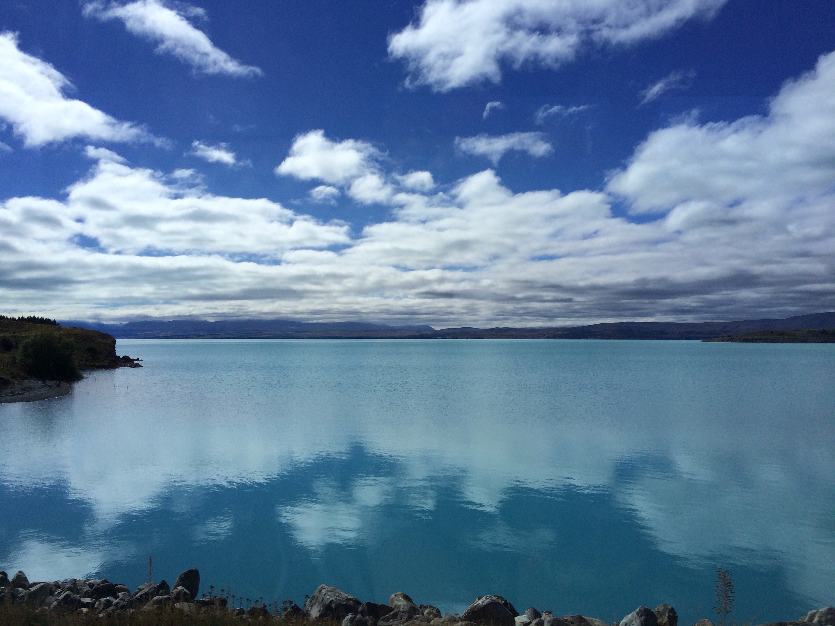
We left Queenstown early on Friday morning. The Remarkables mountain range had a dusting of snow overnight – it’s definitely Autumn now! After a stop in Cromwell for supplies (there are no shops in Mt Cook village), we stopped for lunch overlooking Lake Pukaki. The blueness of the lake is amazing.
We arrived at our accommodation in Aoraki Mount Cook village at around 2pm. Aoraki is the Maori name for Mount Cook, and means ‘cloud piercer’. In the afternoon we went for a walk along the Hooker Valley Track, which is a walk I’d done when I was here back in 2014. The weather was much better this time, and we got some awesome views of Mt Cook on the walk, which we couldn’t even see in 2014.


As the sky was so clear, we were treated to a fabulous view of the night sky in the evening. It’s probably the clearest I’ve ever seen the Milky Way, and we could also see Jupiter and Mars really clearly. The views of the night sky that I’ve seen on my travels really have been something else.
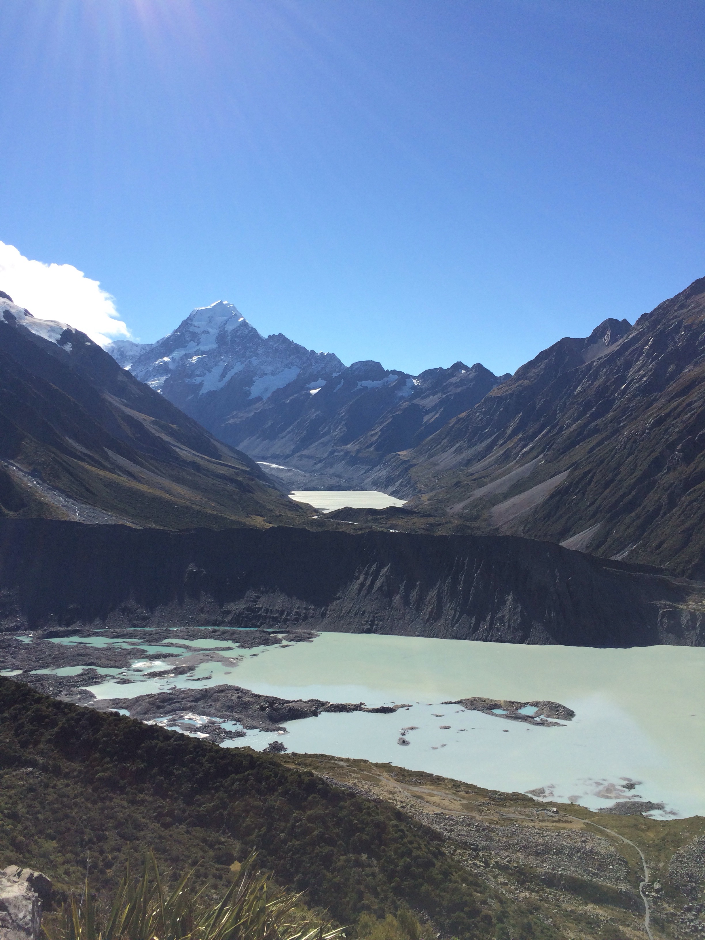
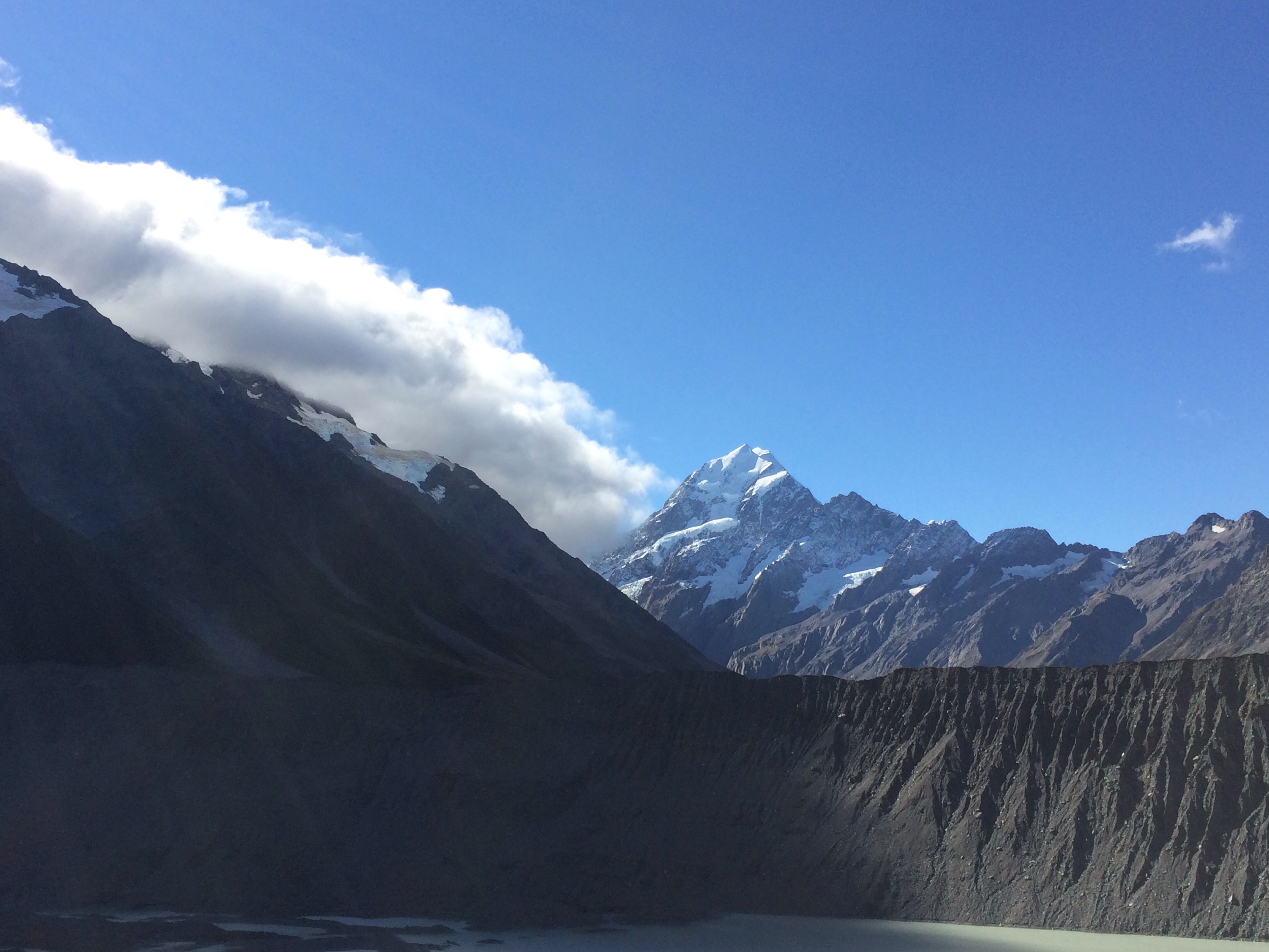
On Saturday I took a 4WD ‘Argo’ trip to the terminal of the Tasman Glacier.
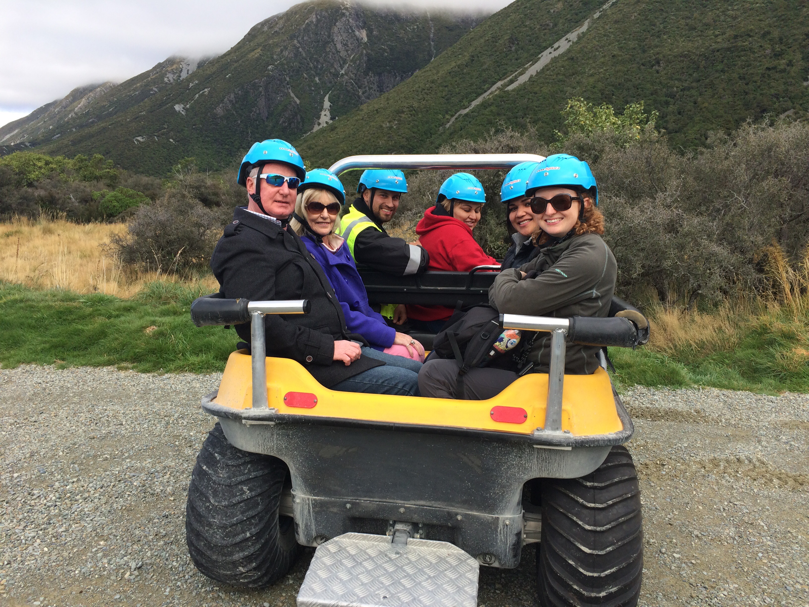
I have to say that this was one of the most uncomfortable journeys I’ve ever had, 5km up a boulder-strewn gravel track, but it was an awesome view when we got to the glacier.

I then spent the rest of the afternoon at the Sir Edmund Hillary Alpine Centre, learning about the first people to ascend various peaks in the Southern Alps, along with watching a 3D short film on Mount Cook, and an interesting documentary on Sir Edmund Hillary’s ascent of Everest in 1953.
In the evening i had a vastly overpriced pint of cider from the bar at the backpackers. It was $11 – £5.50 – basically London prices. I won’t be making that mistake again!!
Today (Sunday) was another beautiful day. I walked up the Sealy Tarns track. This was quite challenging. Roughly 90 minutes of walking up steps, though I suspect fitter people could do it in around an hour. The views on the way up, and at Sealy Tarns lookout, were amazing.

It only took me 45 minutes to get back down, and even with about half an hour for lunch at the top, I was still within the suggested 3 hour time frame for the walk.
I also walked to Kea Point, which was 10 minutes from the start/end of the Sealy Tarns track, and gave another great view of Aoraki Mount Cook.
After my long walk, I treated myself to a bath. Yes, that’s right, this hostel has baths! I love a bath, and it feels like forever since I had one, though in reality it was about 5 weeks ago in Rotorua.
Tomorrow we move on to Rangitata, where I will not be partaking in white water rafting (which is basically the only thing to do in Rangitata). The day after that we head to Christchurch where I will be renting a car for a little road trip…